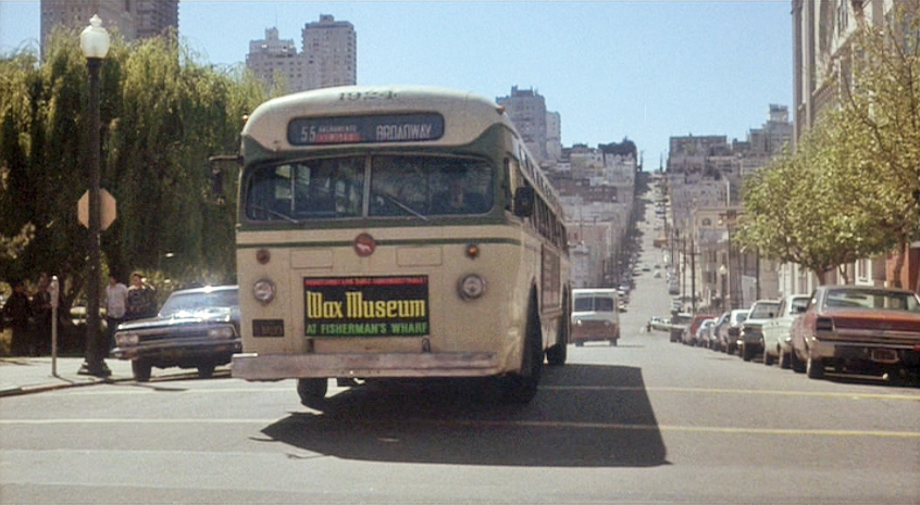
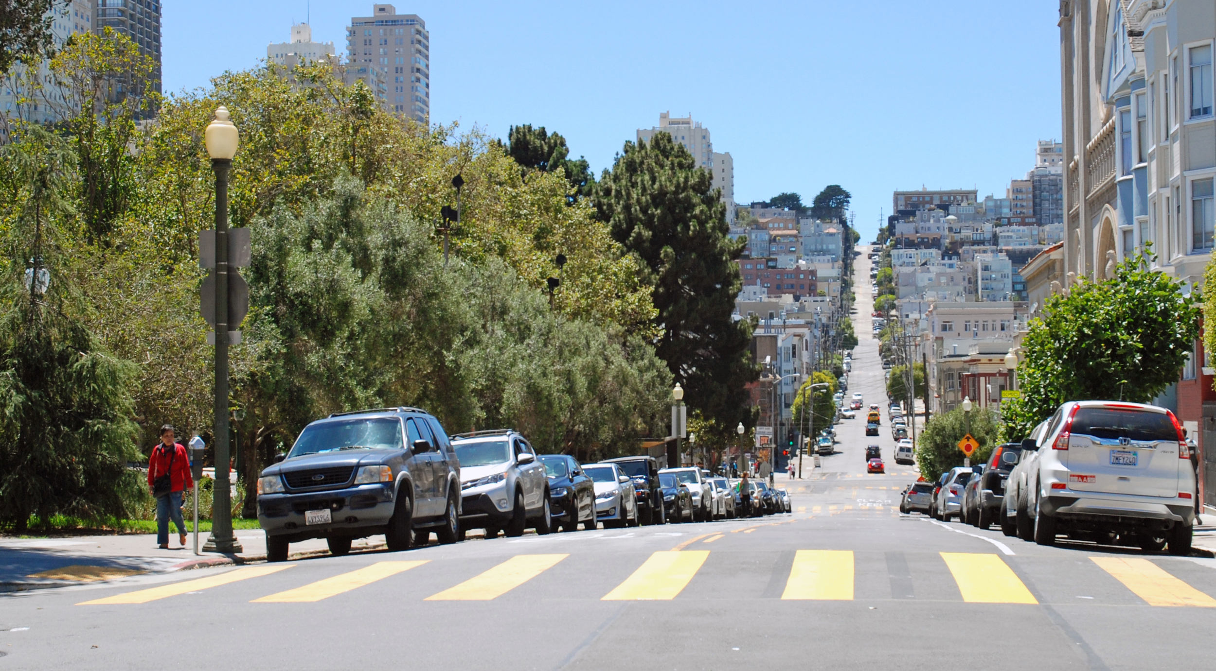
The 55 Broadway bus, carrying Jake and Camerero, passes Washington Square Park on the left and Saints Peter and Paul Church on the right (map), about to make a left from Filbert Street into Stockton Street (in real life there was no such bus line). Throughout the chase, click or tap the image or thumbnail to compare Then with Now.
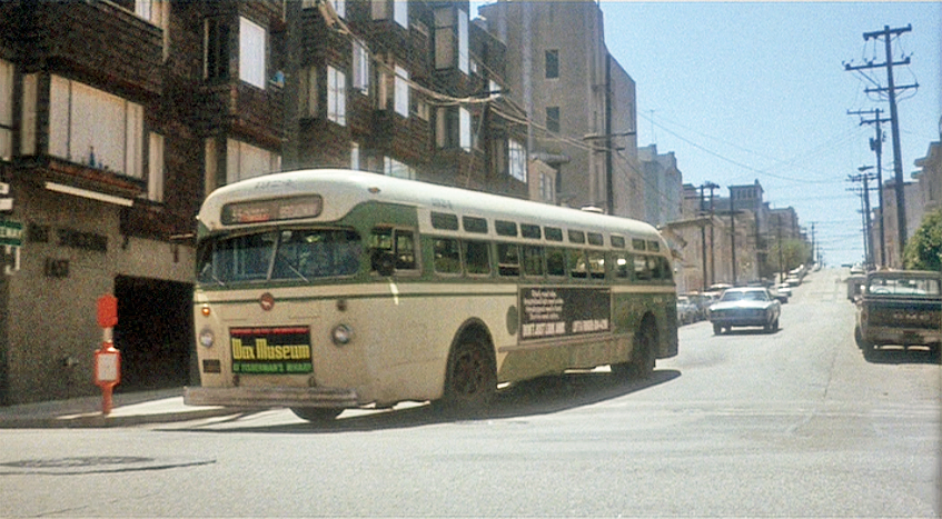
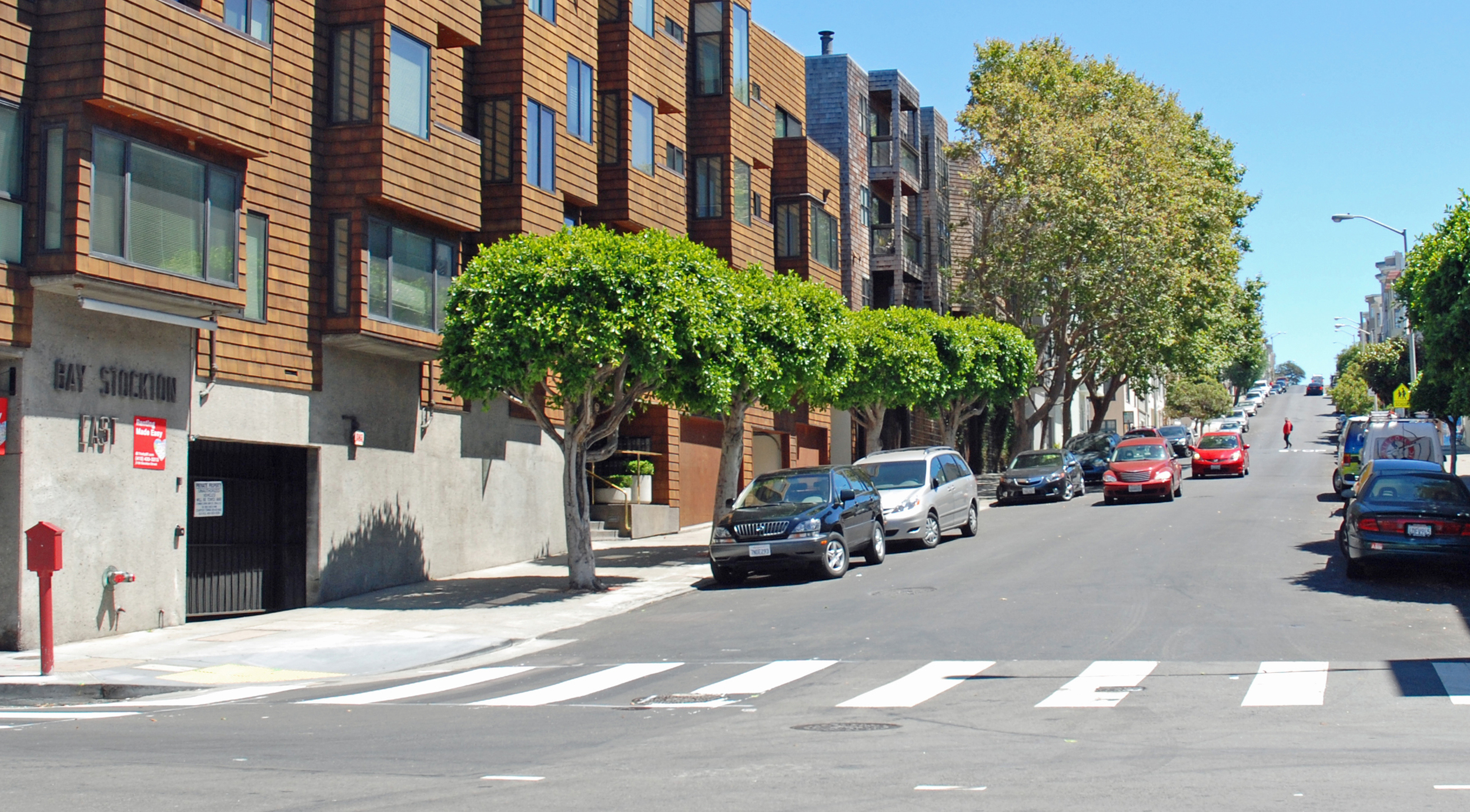
From Stockton the bus makes a right into Bay Street (map) with Larsen following in pursuit.
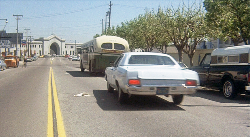
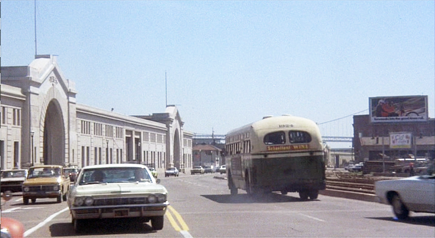
They continue along Bay towards Pier 33 on the Embarcadero.
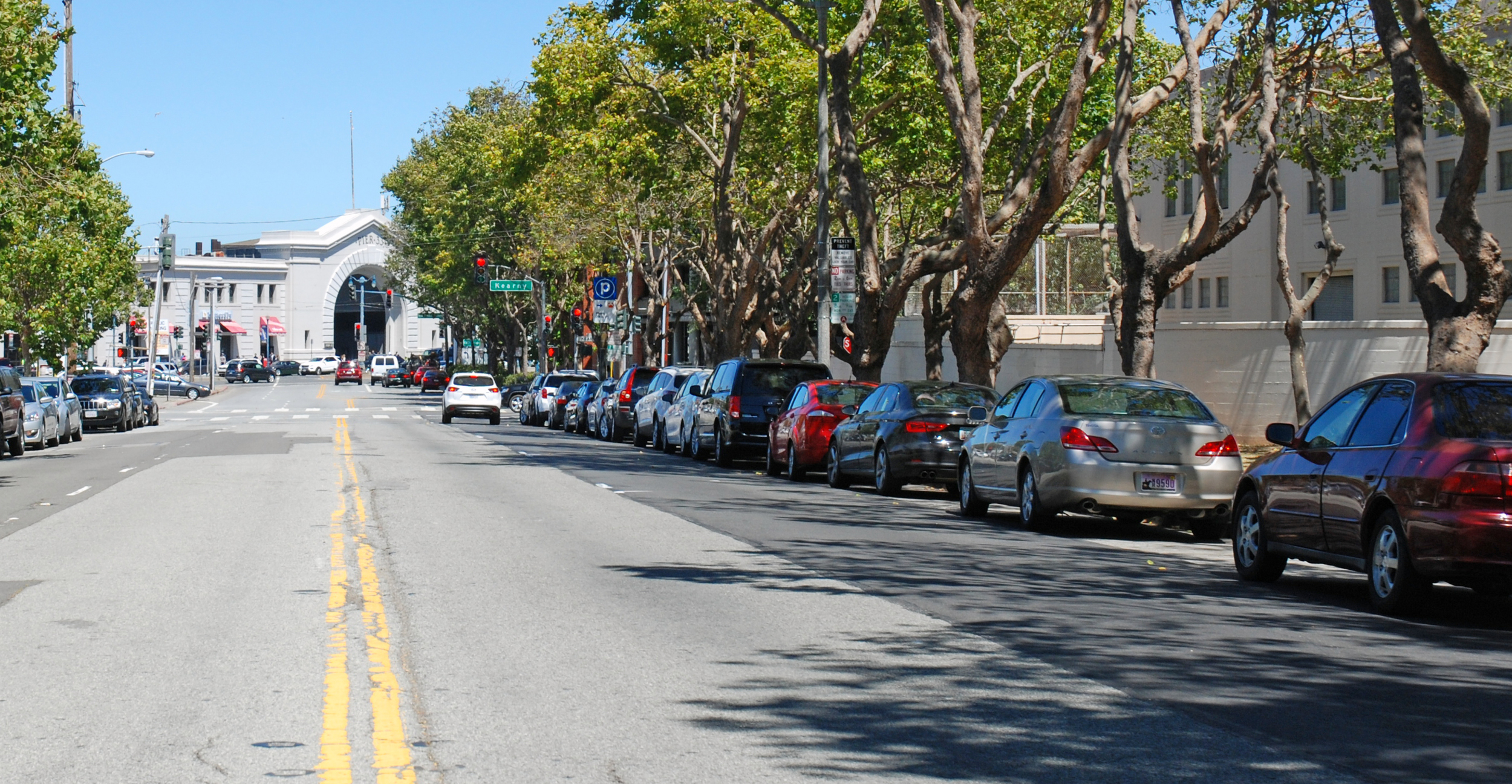
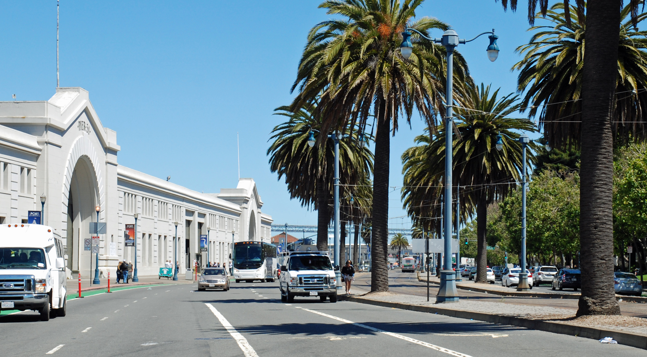
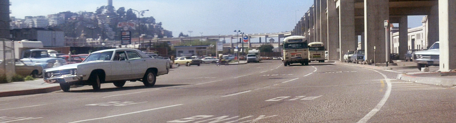
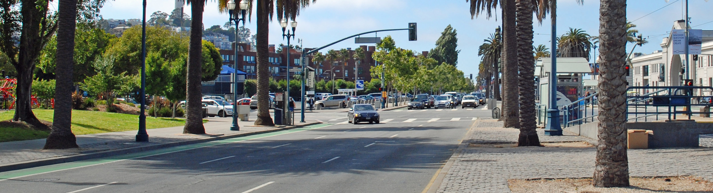
This bus sure goes a long way between stops - here it has turned south down the Embarcadero heading towards Piers 31 and 29 and that's the Bay Bridge in the distance. Today's Embarcadero is wider, with tram tracks and palm trees down the center.
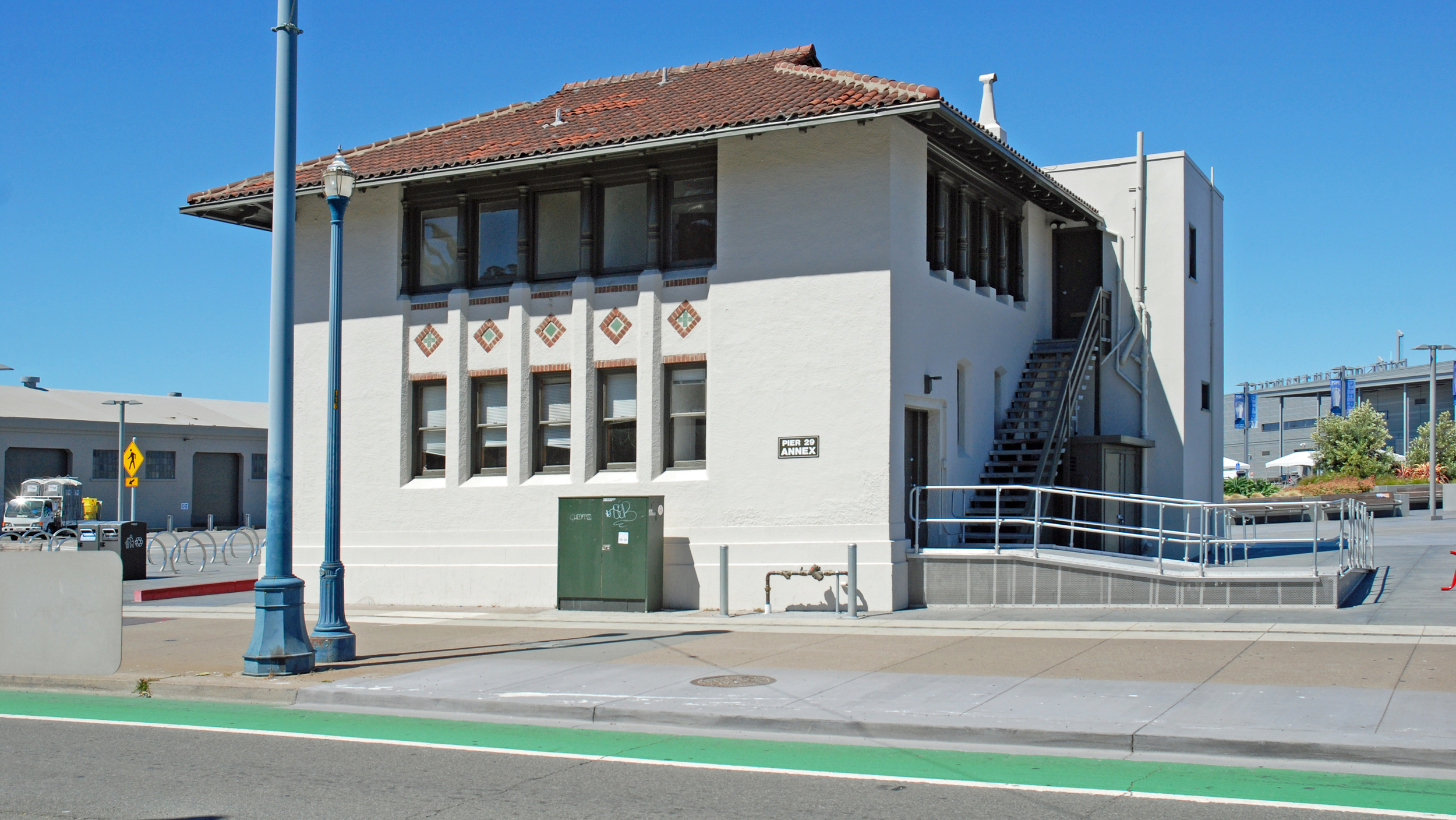
Larsen stays as close to the bus as he can. He's passing the Pier 29 annex, originally the administrative offices for the State Belt Railroad that used to haul goods along the length of the Embarcadero. While adjacent piers 25 and 27 have long since been demolished, that building remains as a lone survivor, now with an ADA-mandated ramp for the handicapped.
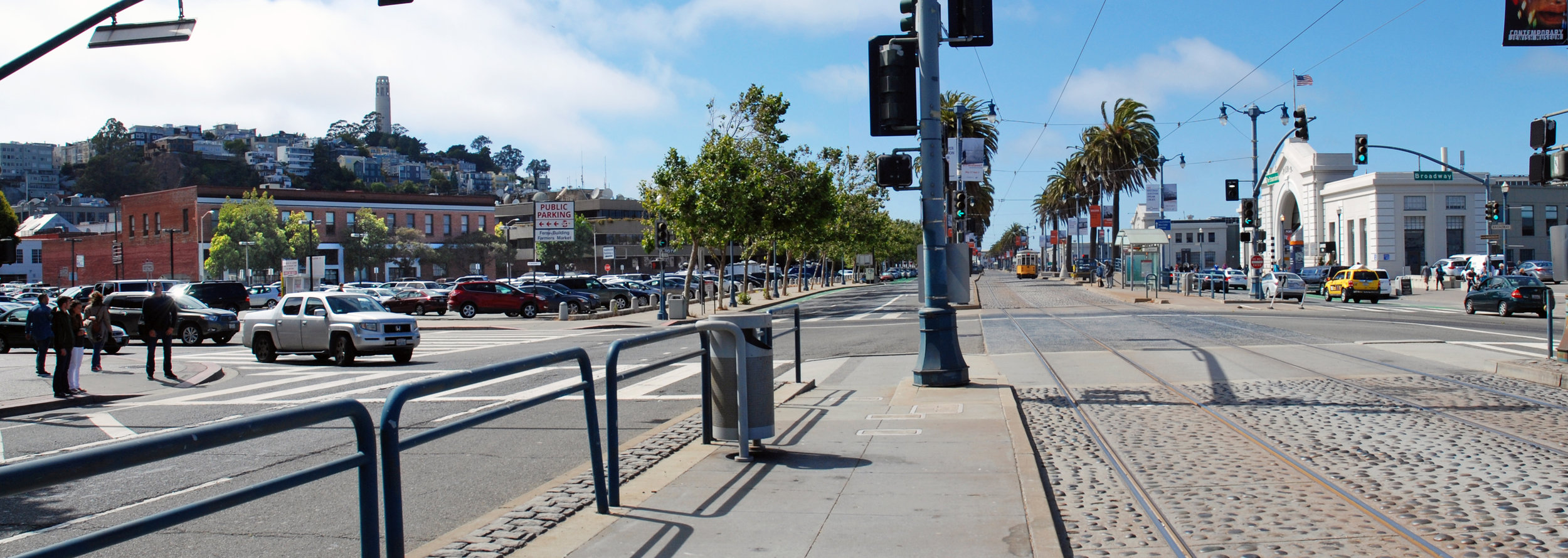
In his haste Larsen swerves, narrowly avoiding another car, before getting back on track. This view looks north along the Embarcadero past Pier 9 on the right. The north end of the Embarcadero Freeway swings left to the Broadway ramps but now the freeway is gone leaving a clear view of Coit Tower atop Telegraph Hill.
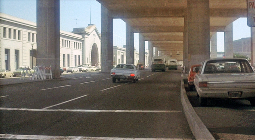
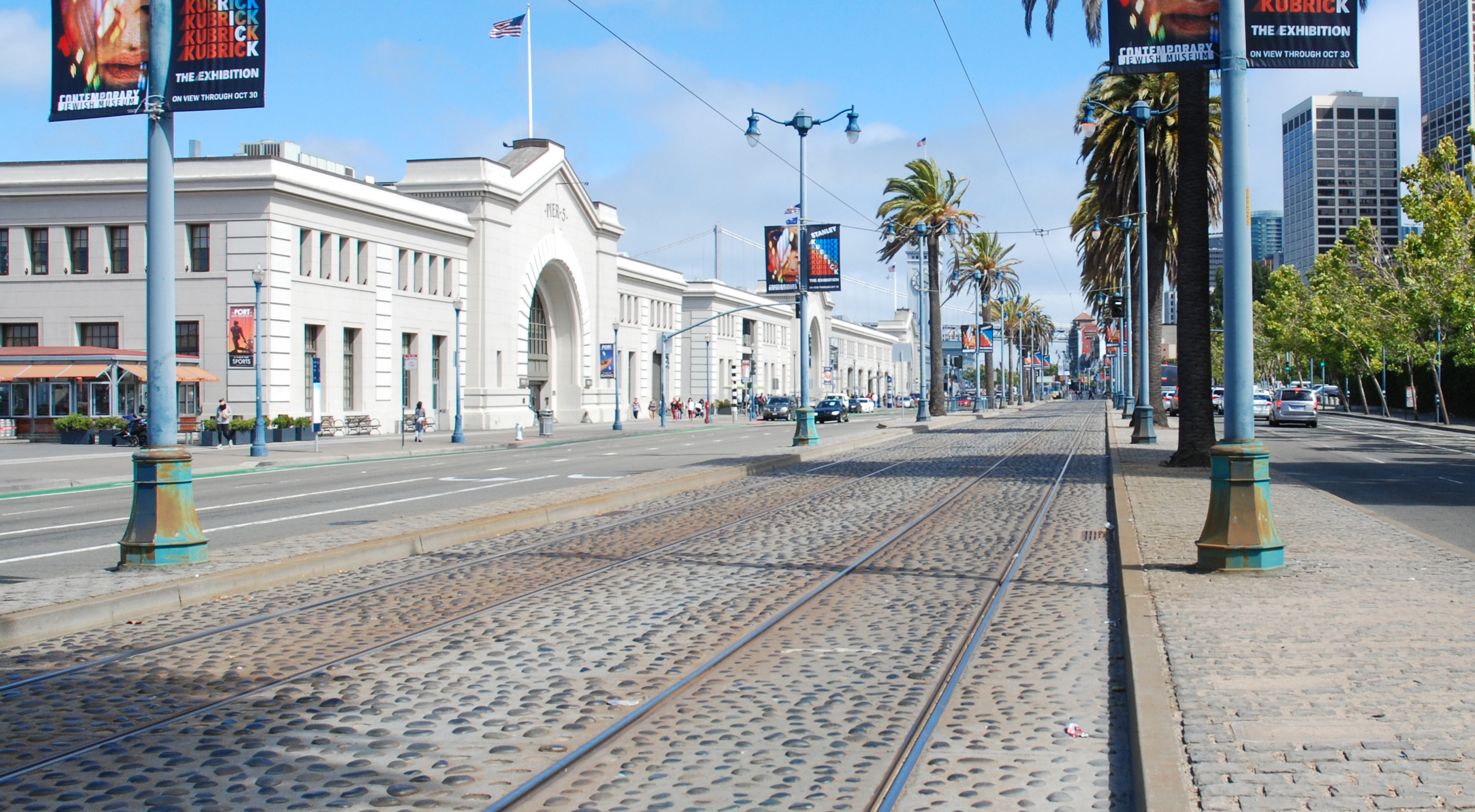
As they approach Pier 5 this shot shows why the Embarcadero Freeway was such a bad idea. The ugly structure isolated the waterfront piers and the Ferry Building a little further on from the rest of the city. Damage from the 1989 earthquake eventually led to the freeway's demise - the recent photo shows how opening up the area and adding tracks for the historic streetcar E and F lines has transformed the waterfront. It also shows that the Pier 5 bulkhead was modified after the adjacent Pier 7 (just out of view at far left in the Then photo) was removed.
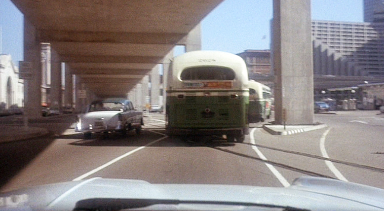
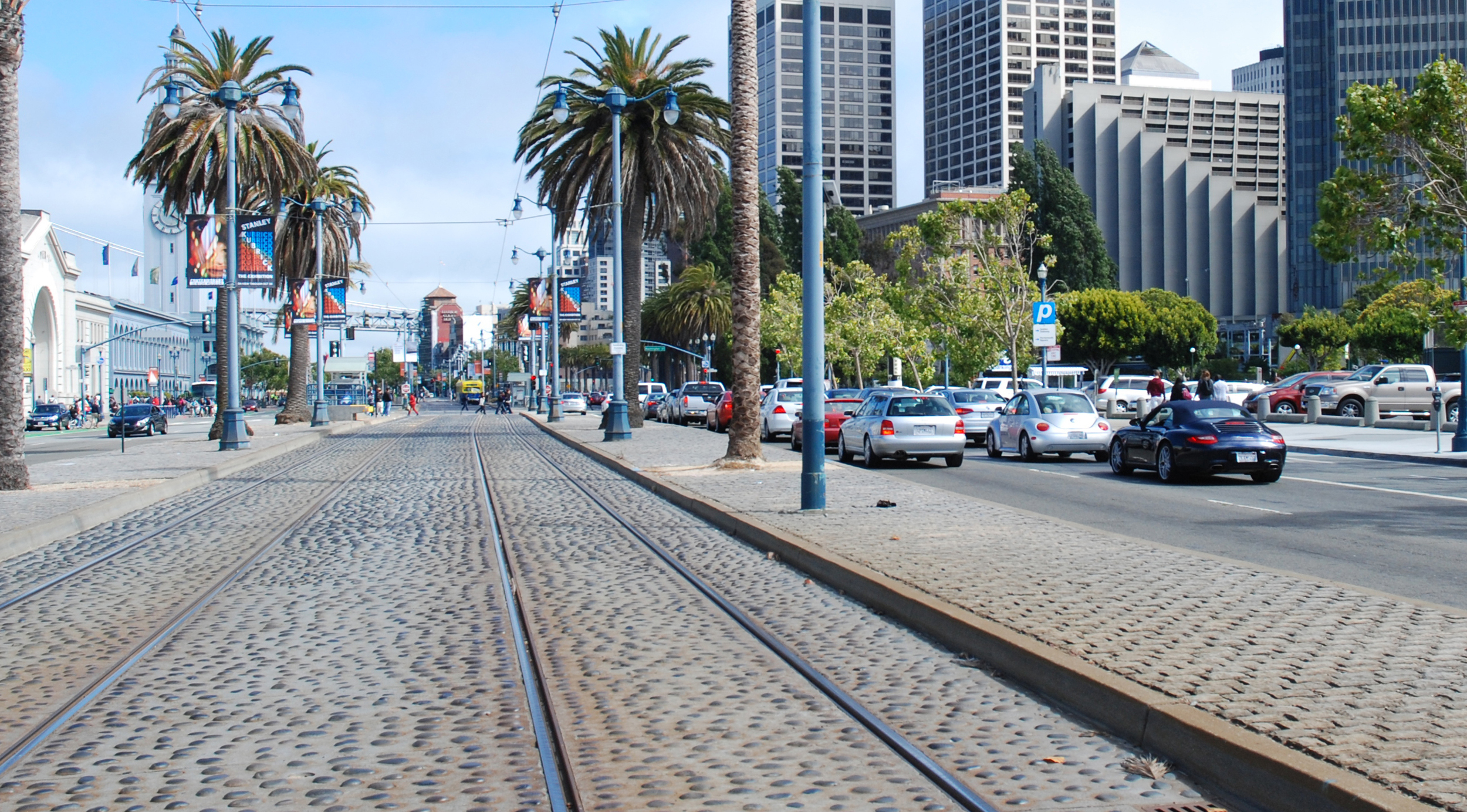
Another bus gets in the way as they approach the Ferry Building on the left and the stylishly ramped Hyatt Regency hotel on the right. The hotel today is surrounded by newer Financial District high-rise office buildings.
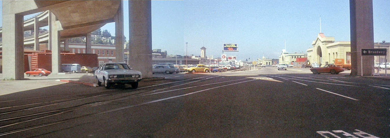
Looking back to the north towards the oncoming bus the end of the freeway at Broadway curves off in the distance. In the foreground Washington Street tees off to the left and there's a Chevron gas station further down, no longer there.
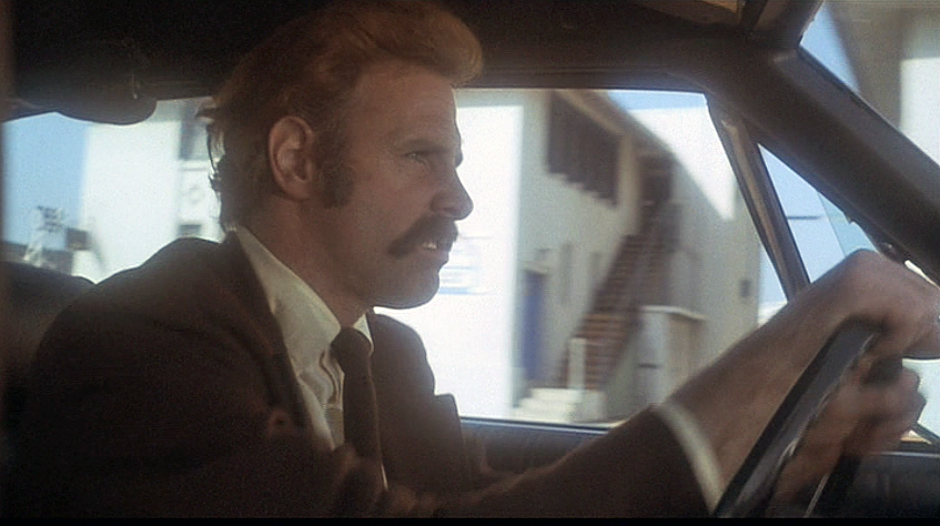
On the bus, Camerero has had enough. Just as he did at the start of the movie he opens his briefcase and furtively assembles his weapon. This can only end badly, will this be another bus massacre? The showdown must come.
CitySleuth is often asked how he finds his locations, especially those that have completely changed or vanished since they were originally filmed. This next location is a good example and he will use it to describe the process that identified it. Although his conclusion is not absolutely 100% verified, he is quite persuaded. You decide.
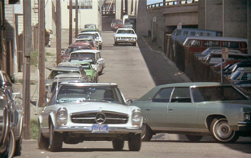
Then ... Frisco Pete is in big trouble. He has just committed a murder and he's being chased through Chinatown by an angry horde. Here, he pauses next to the New Chow Chong Cigar Factory, one of dozens if not hundreds in Chinatown back then. There are quite a few clues in this brief clip: the street number (15), business name and an adjoining passage behind the fugitive leading through to the next street or alley.
... and Now, CitySleuth has concluded that this was 15 Jason Court, formerly named West Court and before that Sullivan's Alley, a very narrow alley off Jackson Street (map). Here it is today.
So what led CitySleuth here? A search of city directories from the year of filming, 1920, contained no reference to the New Chow Chong Cigar Factory No. 101. This however was no surprise - many of Chinatown's small businesses avoided contact and cooperation with city official's attempts at documenting them. There were some Chinese language directories but few have survived, not to mention the translation problem. The number 101 assigned to the Cigar Factory suggests it was part of an organized trade listing but all efforts to find this have been fruitless. Public library records and the Chinese Historical Society on Clay Street were consulted but were no help; those who would have known are long departed.
The first break came from an internet search revealing this entry in a 1905 Chinatown residential directory:
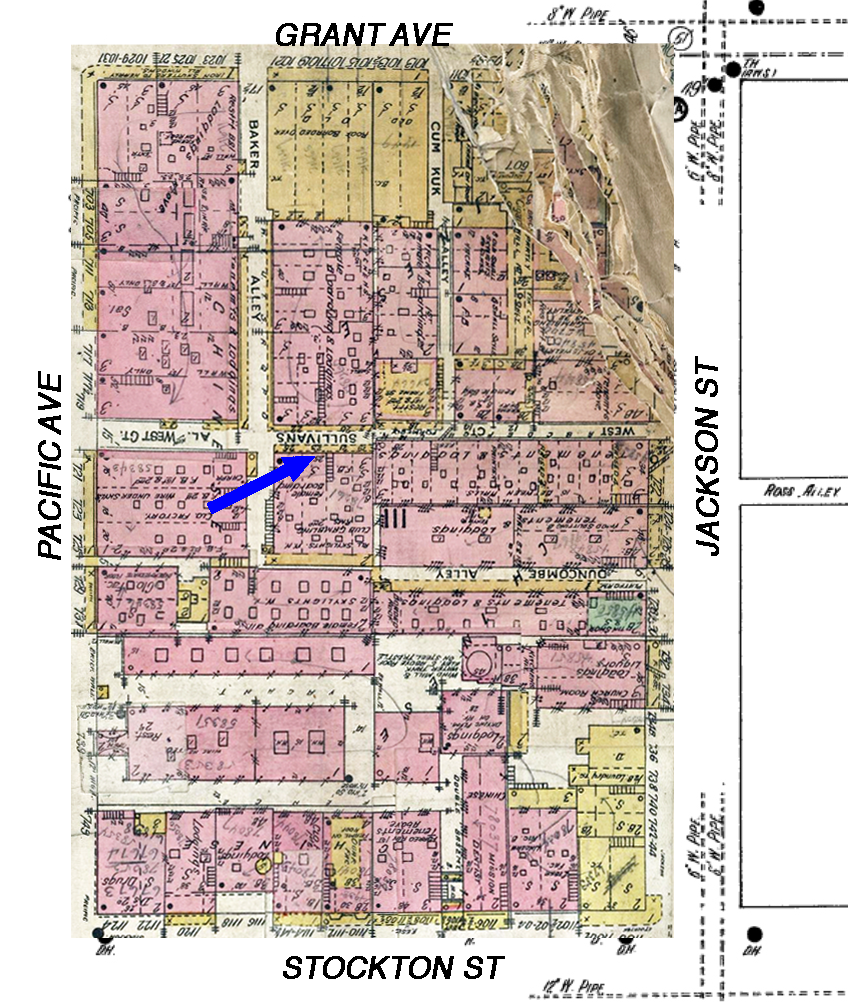
1905 preceded by one year the earthquake and fire which razed Chinatown. Could the 'New' Chow Chong Cigar Factory have been a rebuild of this business after the fire? And where was 23 Sullivan Alley exactly? CitySleuth then came across a remarkably detailed 1905 David Rumsey fire insurance map book which survived fire damage and yielded the answer. The arrow points to # 23, part of a building of multiple small stores, a gambling club and 'female boarding' (the quaint euphemism back then for a whorehouse). Note that the alley in 1905 was called West Court, but marked as 'formerly Sullivan's Alley'. It traversed the entire block from Jackson to Pacific. Grant Avenue, then called Dupont Street, crosses at the bottom (click on the image to enlarge it).
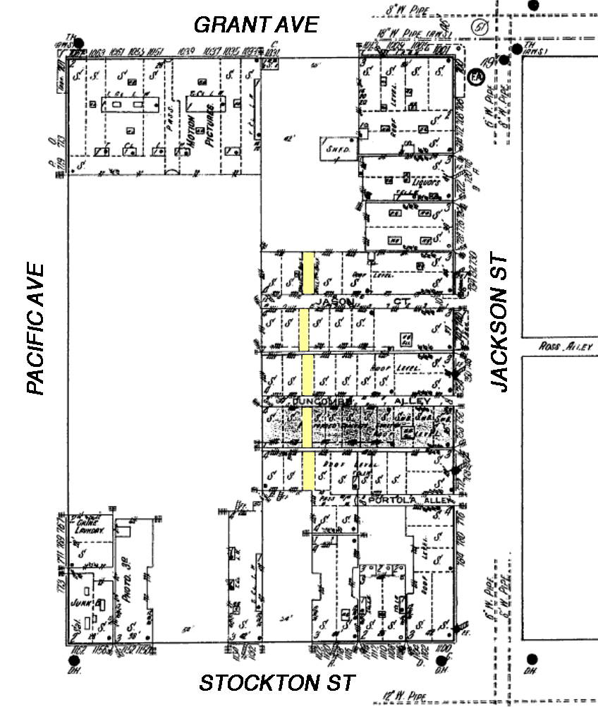
After the fire Chinatown was totally rebuilt including, by 1913, about 3/4 of this block, shown below on a Sanborn fire insurance map (note that the orientation is rotated 180 degrees compared to the above 1905 map). Sullivan's Alley has been renamed Jason Court, becoming a dead end alley only half as long as it used to be. No doubt as a reaction to the fire, several ground-level passages (highlighted in yellow) were constructed as an evacuation route. Click or tap the image to toggle to an aligned overlay of the 1905 pre-fire block. The original cigar factory location is indicated by the blue arrow - it shows that it was not located in the surviving Jason Court.
Here's a closer look. The blue lines indicate where the alley extension used to run (in 1913 this area was an open lot; today it's part of the Ping Yuen Public Housing project); again the blue arrow points to where the Chow Chong factory was in 1905. Note that in 1913 #15 Jason Court (black arrow) is alongside one of the passages, like in the movie. What's more, if you look carefully at the movie image (at the start of this blog post) you can see from the brick walls on either side that the camera had been set up across from the cigar factory in yet another passage - CitySleuth surmises it was at the spot marked by the red cross. The passages offer strong evidence supporting 15 Jason Court as the new site for the burned-down original.
But here's the clincher - Note that the foundation level of the shop was slightly higher than that of the adjoining passage. 96 years later, 15 Jason Court is exactly the same. Quod Erat Demonstrandum. Anal is as anal does.
Jason Court today, viewed from Jackson Street, has hardly changed since the post earthquake rebuild. #15 is on the left near the end of the alley. The connecting passages have long since been converted to shops and businesses; every square inch is precious in San Francisco's precious Chinatown.
Maude has 'acquired' a pickup truck to take the wilting tree to a new home. In a sequence of sketch-like scenes she encounters a motorcycle cop, confounding, bamboozling and just plain embarrassing him as he tries his inadequate best to uphold the law. If it weren't so hilarious we'd feel sorry for the poor guy.
Then ... The fun begins when she zooms through a toll plaza without stopping, triggering an alarm. This was filmed on Highway 84, on the east side of San Francisco Bay, leading to the Dumbarton Bridge. The barren hill beyond the plaza is the Dumbarton Gravel Quarry.
... and Now, Highway 84 was rerouted in 1982; there's now a new toll plaza located several hundred yards away. This section of the original highway is Marshlands Road. Its old toll plaza gone, it's now part of the Don Edwards San Francisco Bay National Wildlife Refuge in Fremont (map). The quarry, hidden from here by trees, is now a huge, yawning gravel pit, its site slated soon to become a new 100 acre hiking and camping regional park.
This recent aerial shows the relative locations of the old and new toll plazas.
Then ... A motorcycle cop (Tom Skerritt, in a great cameo) chases after her from the toll plaza, eventually pulling her over. Maude cheerfully admits to not having a license... "I don't believe in them", nor owning the truck. As for the tree... "It's not mine really, but we would like to get it into soil as soon as possible". With that she roars off, leaving him agape.
... and Now, this spot alongside Highway 84 is about a third of the way across the bay (map).
Then ... As she drives away the gobsmacked cop is frantically mounting his bike to give chase. The brief glimpse of the structure at far left was all that was needed to pinpoint this exact spot.
... and Now, it's the KGO transmitter facility, serving both sides of the bay from this location since 1947.
Then ... When Maude is pulled over a second time she decides to have some fun...
... and Now, this section of the old road is alongside an elevated section of the new (map).
She lets loose with a tire-squealing series of tight 360's with the hapless cop in tow; he ends up stalling his bike.
Then ... For good measure she circles him one more time before continuing westwards, leaving him stranded there, fuming. Ahead of them at far right is the vertical-lift span of the Dumbarton Bridge that enabled water-borne traffic to get by.
... and Now, the old and new causeways are side-by-side in this recent image taken from the bike lane of the elevated highway. Left of center to the south is the Dumbarton rail bridge, not quite visible in the movie view above, unused since 1982.
Then ... As they approach the vertical-lift span Maude has already forgotten about the cop... "Is the little tree all right?", she asks.
... a vintage photo ... The lift span was built in 1927. Here it was, alongside the new road that obsoleted it, in this north-facing photo in 1984 shortly before it was demolished by controlled explosion (watch that here). At the moment of the above capture they were just to the right of the span, traveling from right to left, westwards.
Maude finally finds the right spot to replant the little tree, giving it a new lease on life. CitySleuth has no idea where this was filmed.
Inspired no doubt by the popularity five years earlier of the car chase in Bullitt, director Stuart Rosenberg decided to include one in this movie. As in Bullitt, the chase makes arbitrary geographical jumps around the city. It starts out in the Financial District, cuts to SoMa then over to Potrero Hill/Dogpatch before ending up in North Beach.
Throughout the chase, click or tap the image or thumbnail to compare Then with Now.
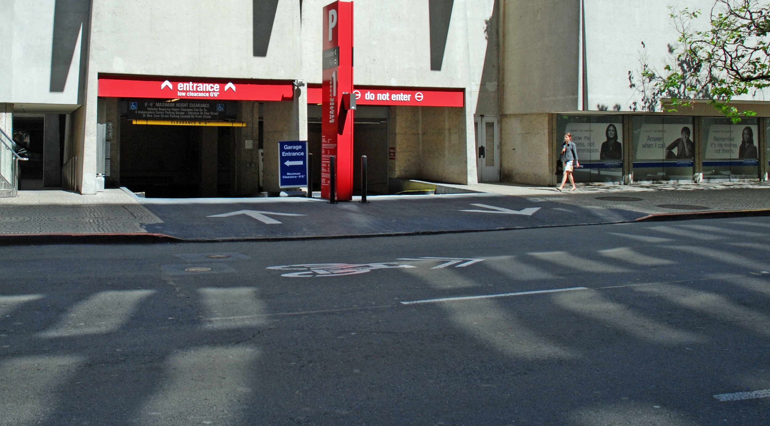
The dogged duo watch from their unmarked police sedan, a late 1960s Ford Custom, as Camerero pulls out of the Battery Street exit of One Embarcadero's underground garage in the Financial District (map). He's driving what has become a classic, a Mercedes-Benz 250 or 280 SL with the 'pagoda' concave top.
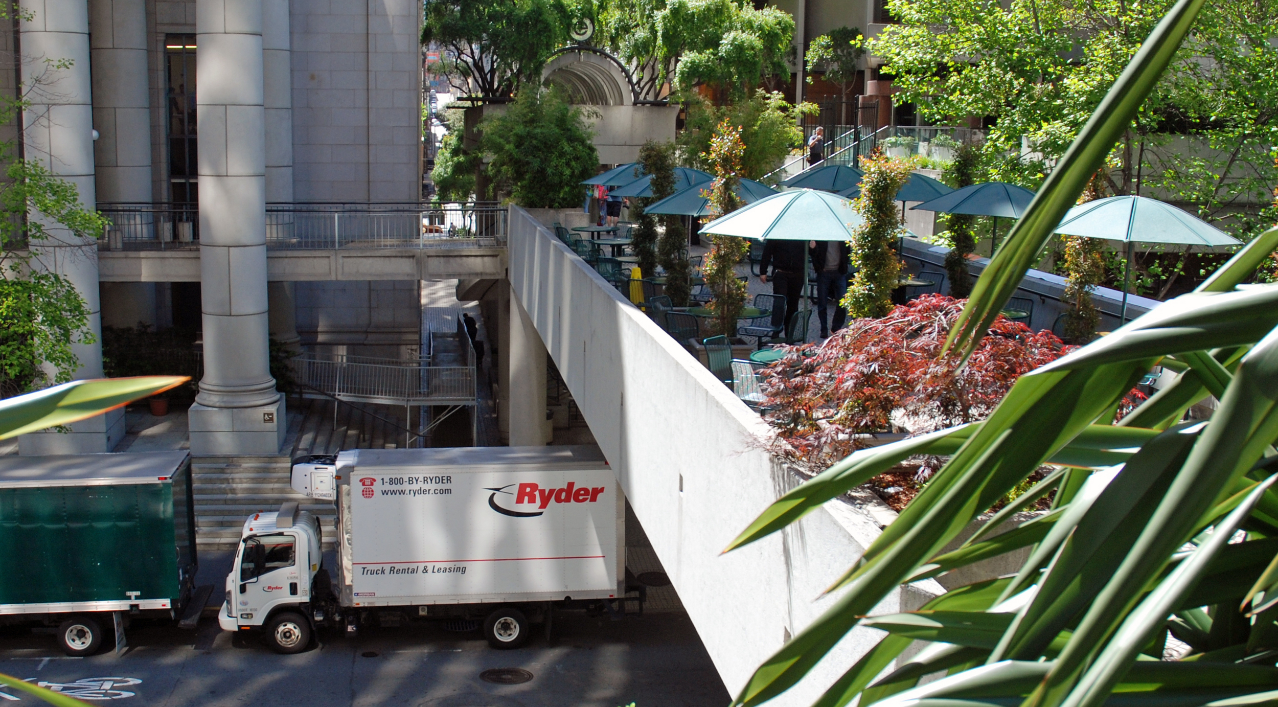
Camerero spots them and decides to shake them off. He speeds west down narrow Commercial street towards Sansome (map) with Larsen in hot pursuit; on the left is the Federal Reserve Bank building, now called the Bentley Reserve. This block today is pedestrian only, accessed by an overhead bridge across Battery from One Embarcadero Center.
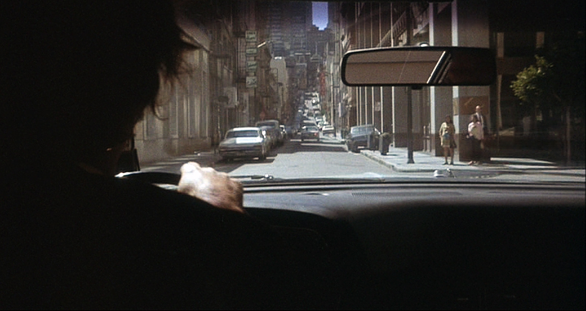
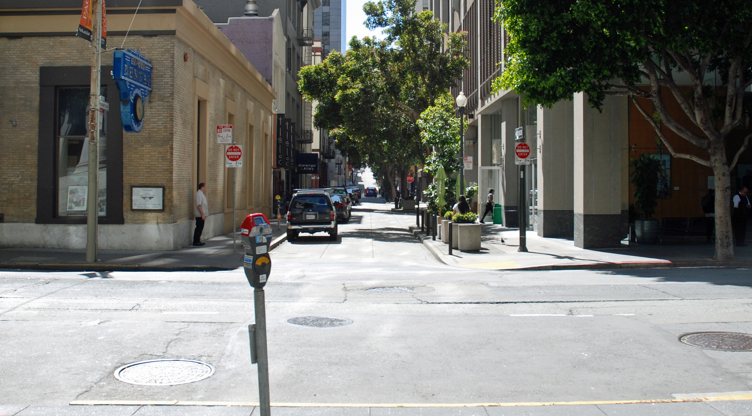
Larsen follows the Mercedes across Sansome as it continues west along the next block. Way ahead, Commercial goes on to dead-end in Chinatown at Grant Avenue.
Next, both cars make a hard left out of Battery into Clay (map)...
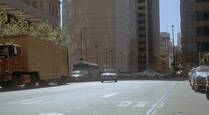
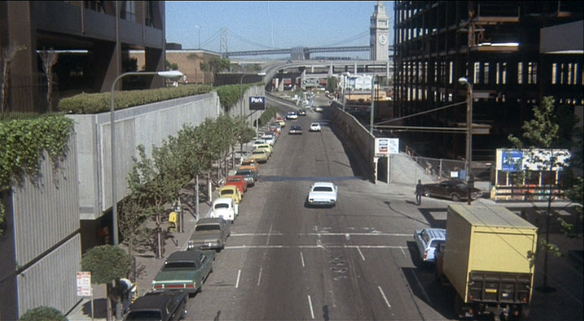
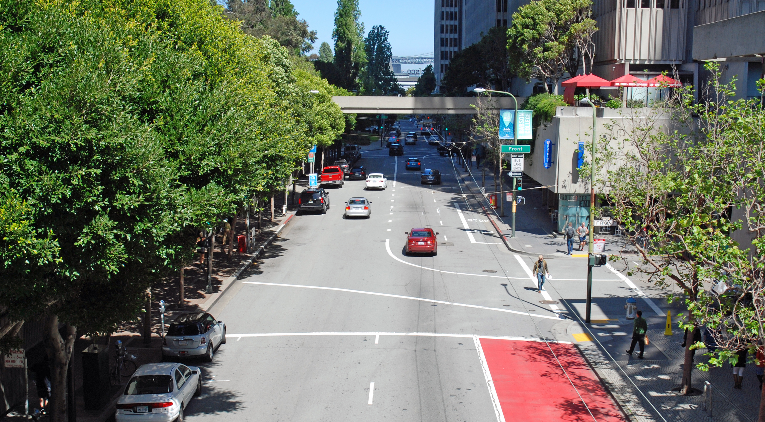
... they continue east along Clay past Front Street. The Golden Gateway Redevelopment Project is in full swing; the old Produce Market has been swept away, the Alcoa Building already complete on the left and Two Embarcadero Center under construction on the right (map). Ahead is the Ferry Building and the Clay Street on-ramp to the eyesore double-deck 480 Embarcadero Freeway (demolished in 1991 after being damaged in the 1989 Loma Prieta earthquake).
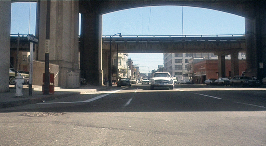
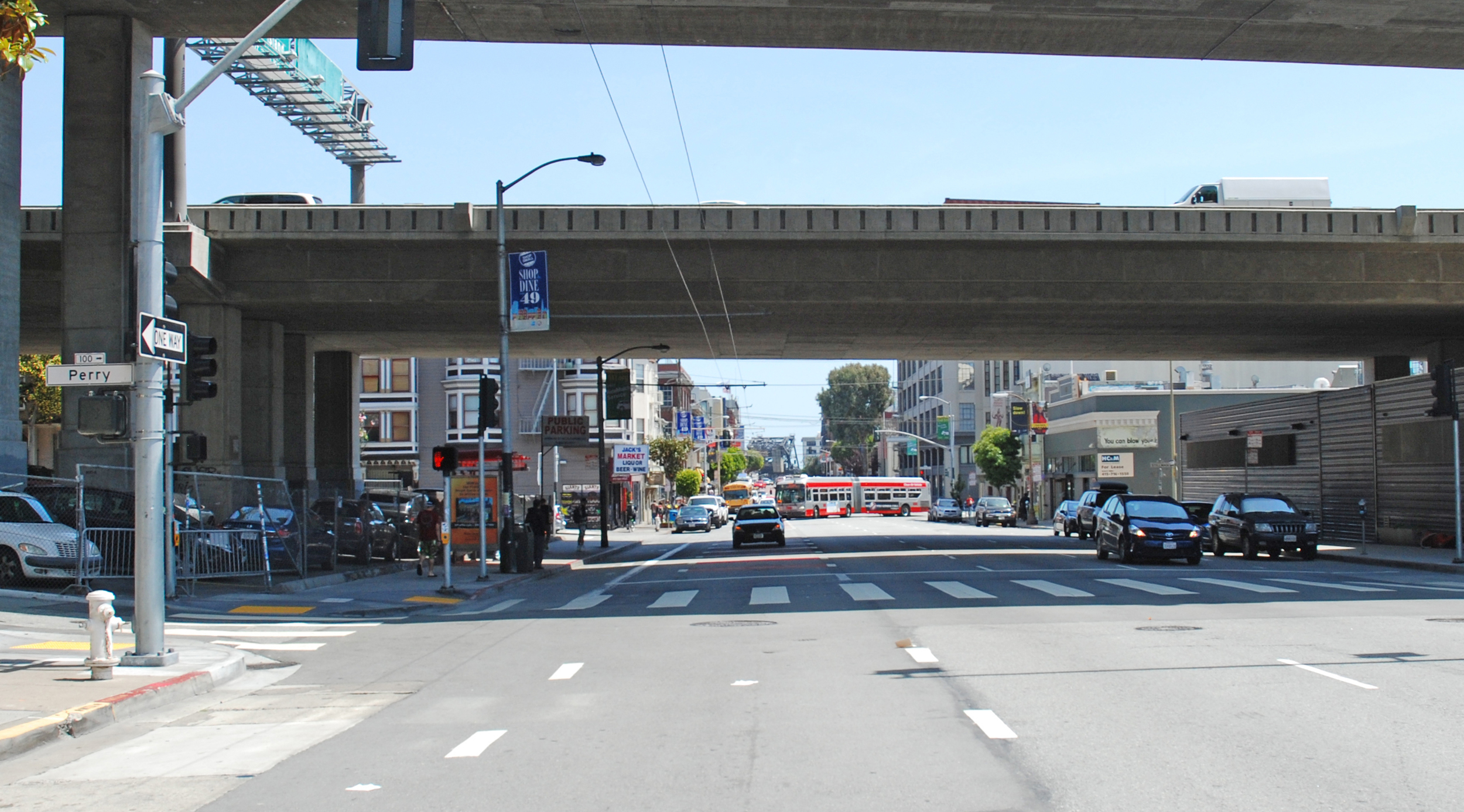
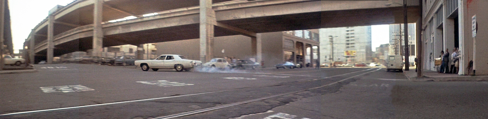
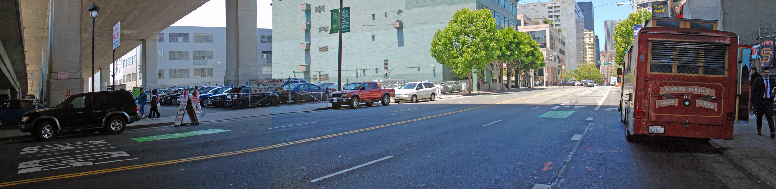
A geographical leap to the South Of Market neighborhood catches up with the action as Camerero, heading north on 3rd Street under the Interstate 80 and 480 freeways (map), is about to make a sharp turn to his right into narrow Perry Street. Both elevated freeways have undergone changes since then.
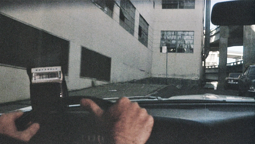
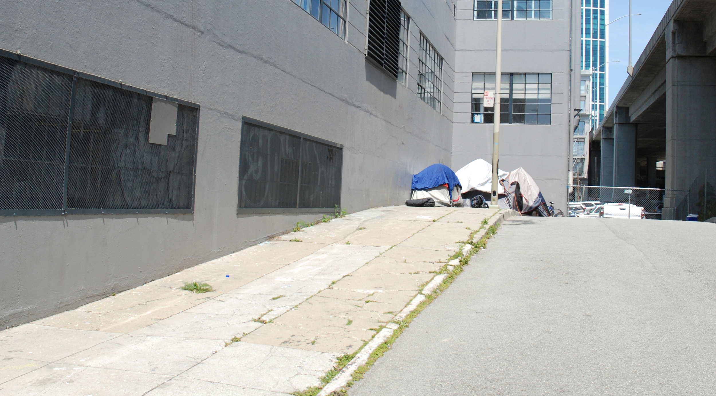
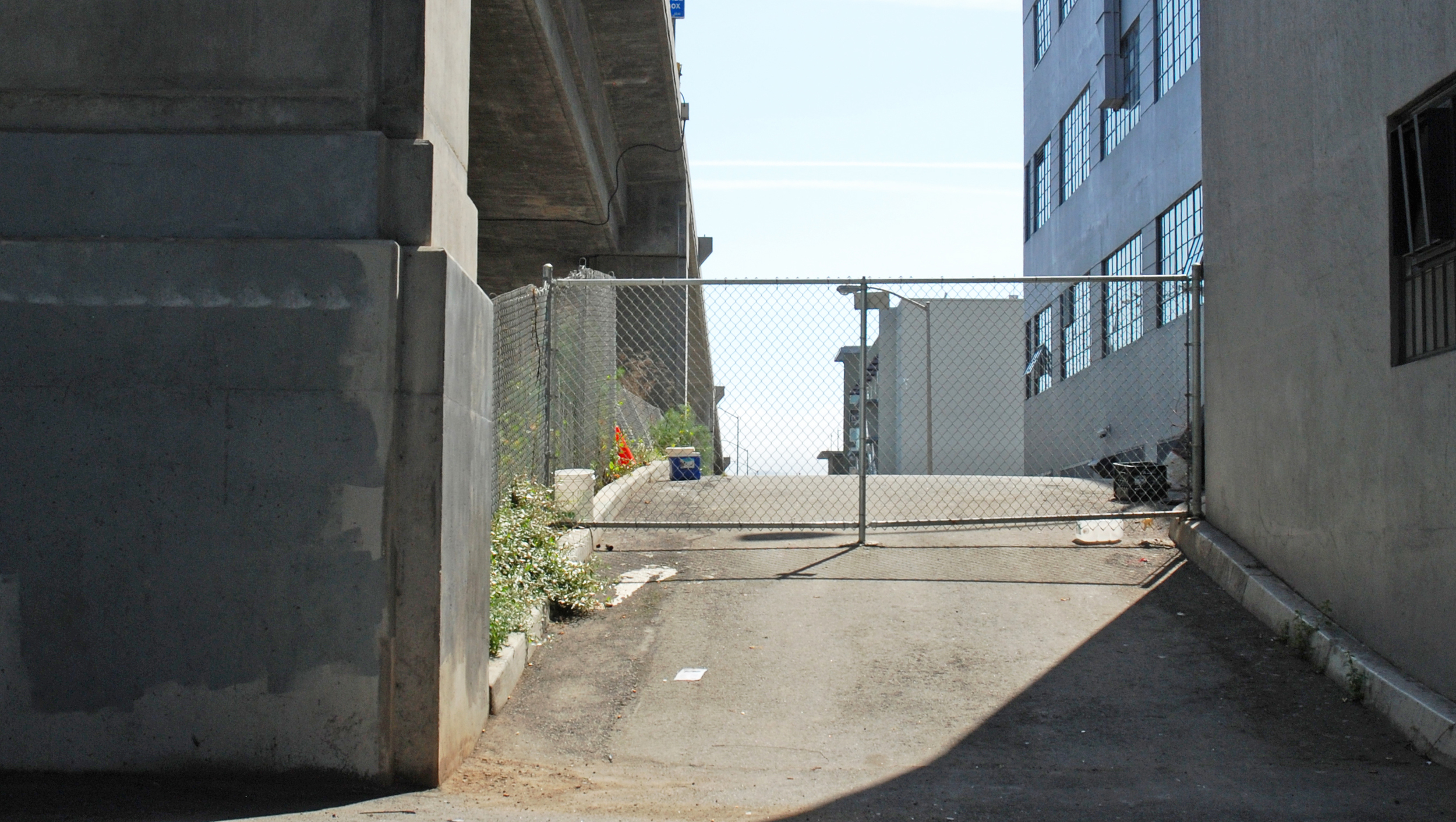
They head east over a sharp crest on Perry Street alongside the freeway (map). In the Now image a homeless group has decided this is a good place to call home.
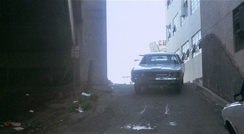
Larsen, cresting the hill, is about to unknowingly drive right by Camerero who has sneakily pulled in to one side...
... then when they emerge onto 2nd Street (map) they make an immediate U-turn and head back to find Camerero. In this view the 80 freeway is at far left from which the 480 freeway peels off, crossing 2nd towards the Embarcadero. Demolished following the 1989 earthquake, this section has since been replaced by a west-bound addition to the 80 freeway.
They backtrack along Perry and spot Camerero ahead of them. In a slick piece of stunt driving the Mercedes, crossing 3rd Street, is almost broadsided by a spinning green sedan forced to slam on its brakes.
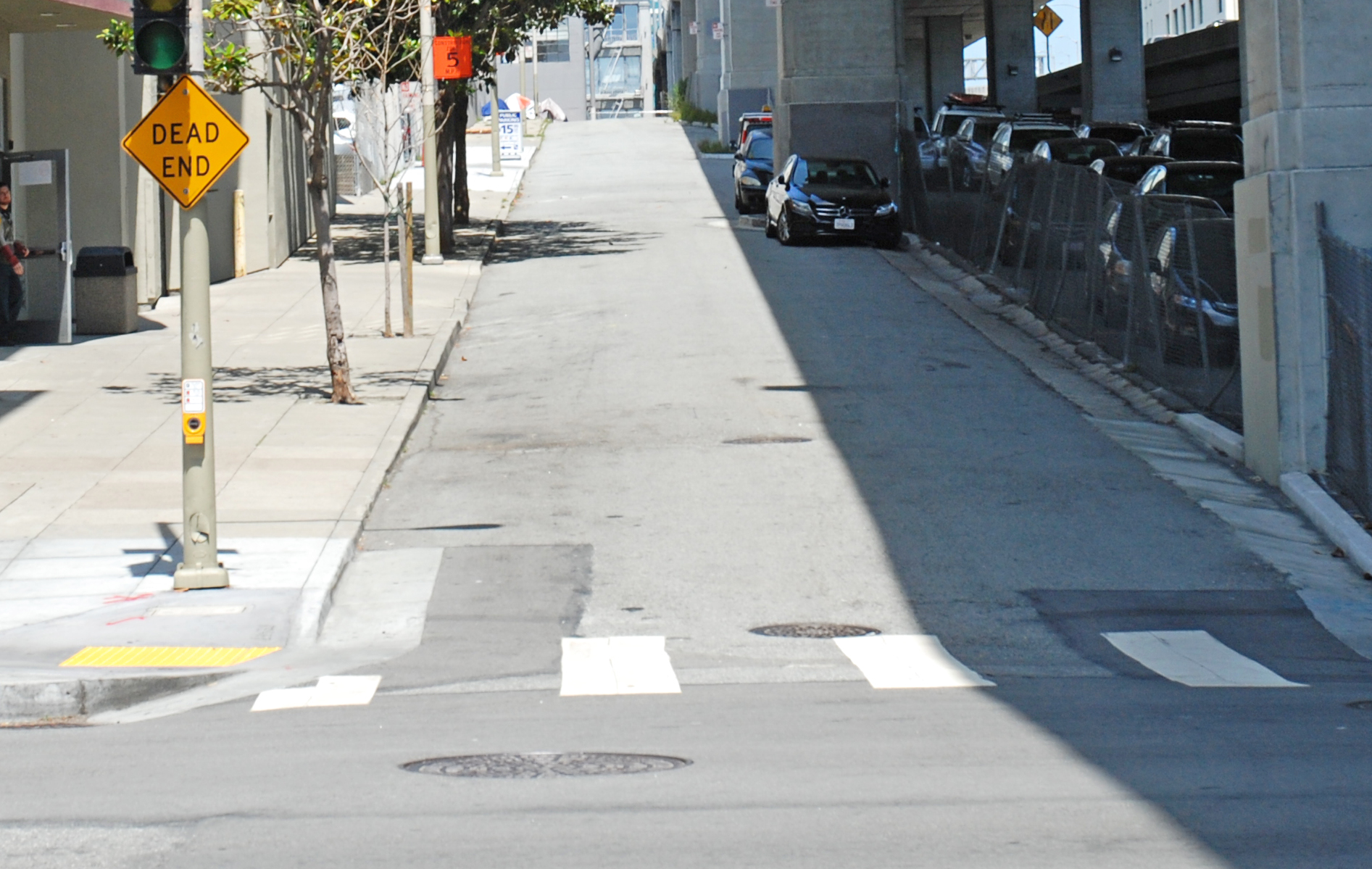
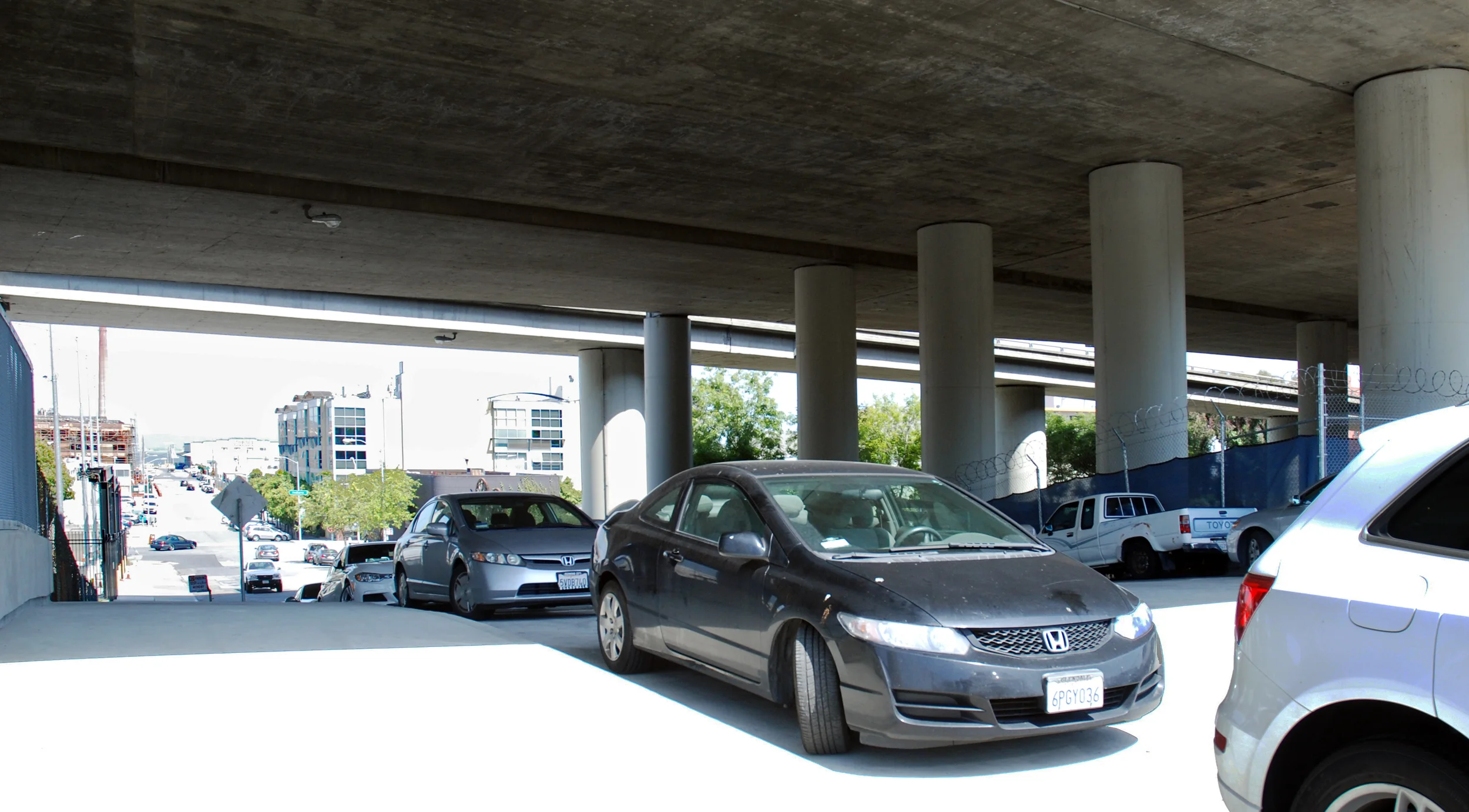
The next cross-town segue takes us to Potrero Hill. The chase continues north on Iowa under the 280 freeway, approaching 23rd Street (map). The recent image shows seismic upgrades to the freeway supports.
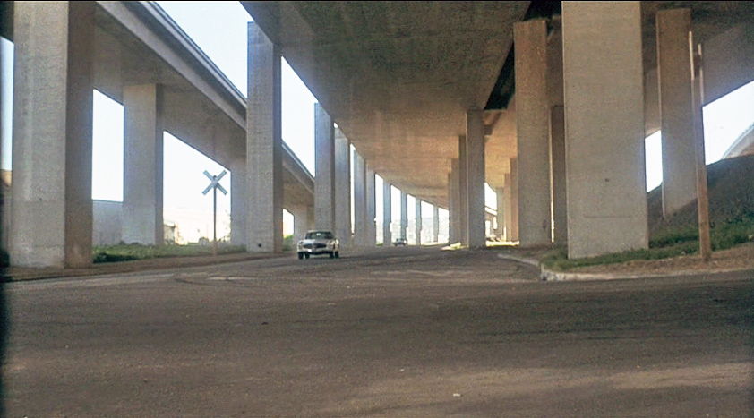
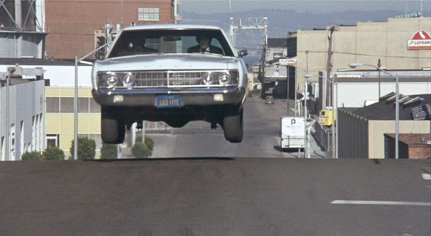
Camerero turns left into 23rd and uses the steep half-block incline under the 280 freeway to launch the Mercedes into the air. The thriving industrial area these days is packed daily with bumper-to-bumper parked cars.
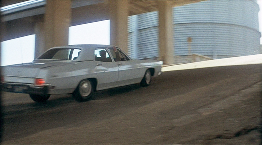
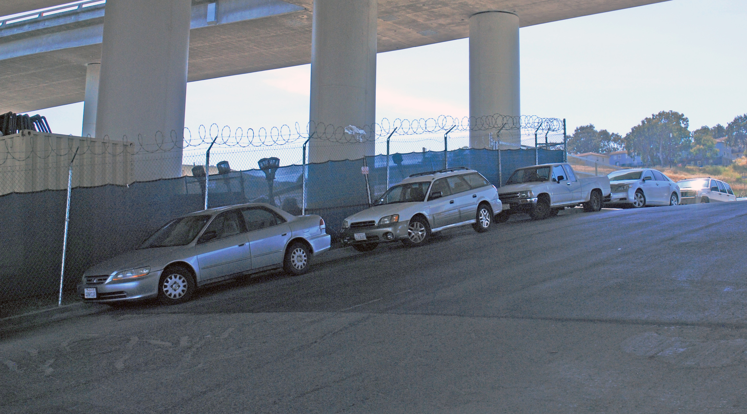
Larsen guns it up the same slope, about to get air himself. Note the huge storage tank on the corner of 23rd and Pennsylvania - it's gone now.
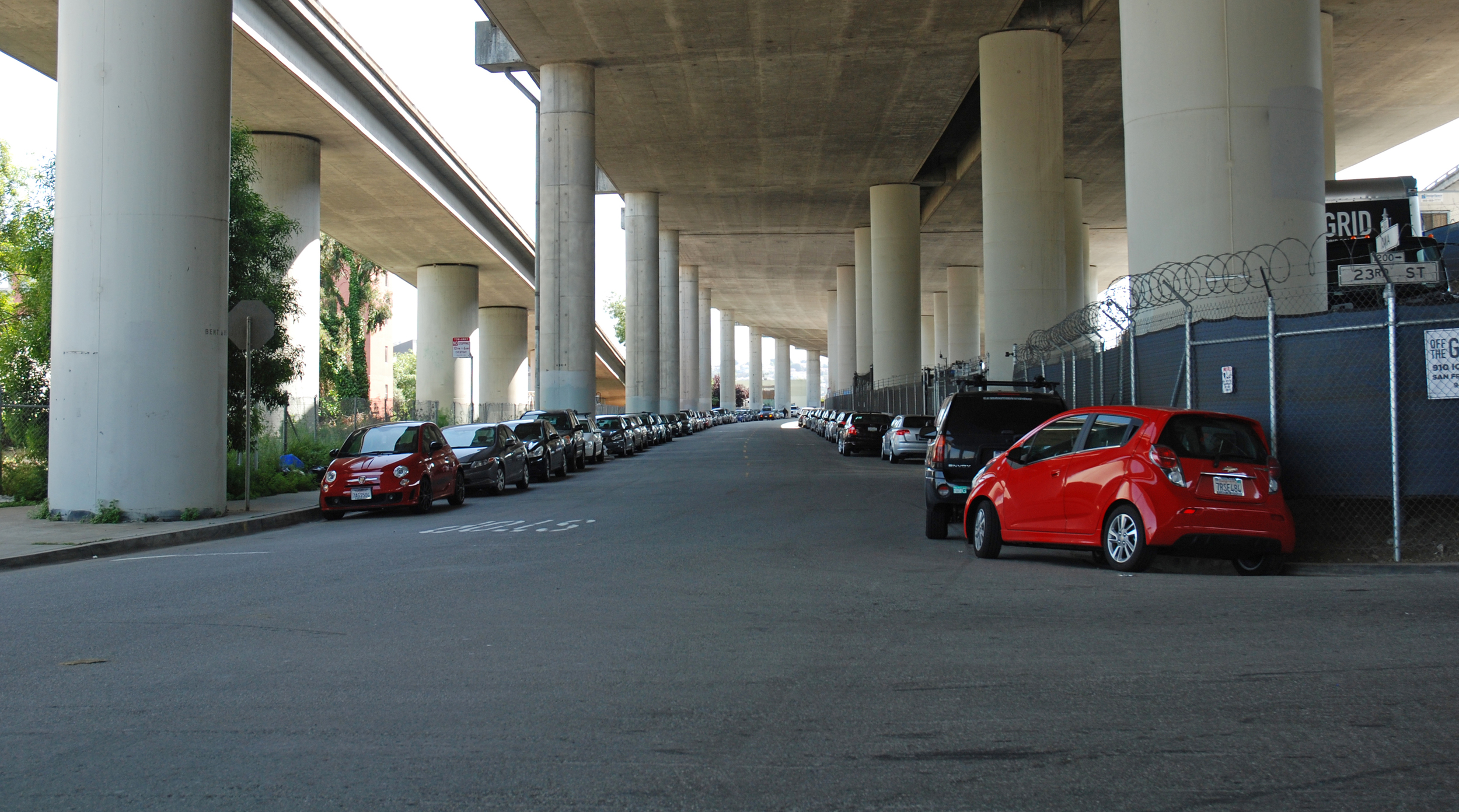
The site of the storage tank is now occupied by an anti-hunger organization, the San Francisco Marin Food Bank.
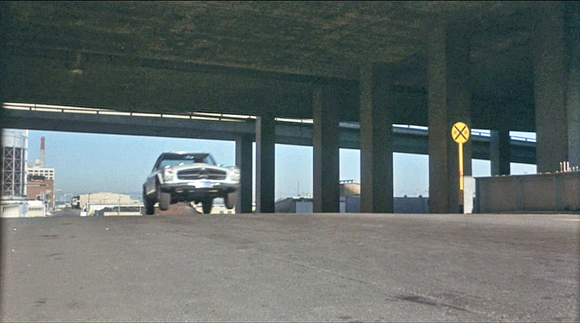
The hefty Ford gets even more air than the Mercedes did. Behind them 23rd Street recedes east through the Dogpatch neighborhood to San Francisco Bay.
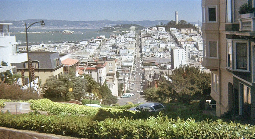
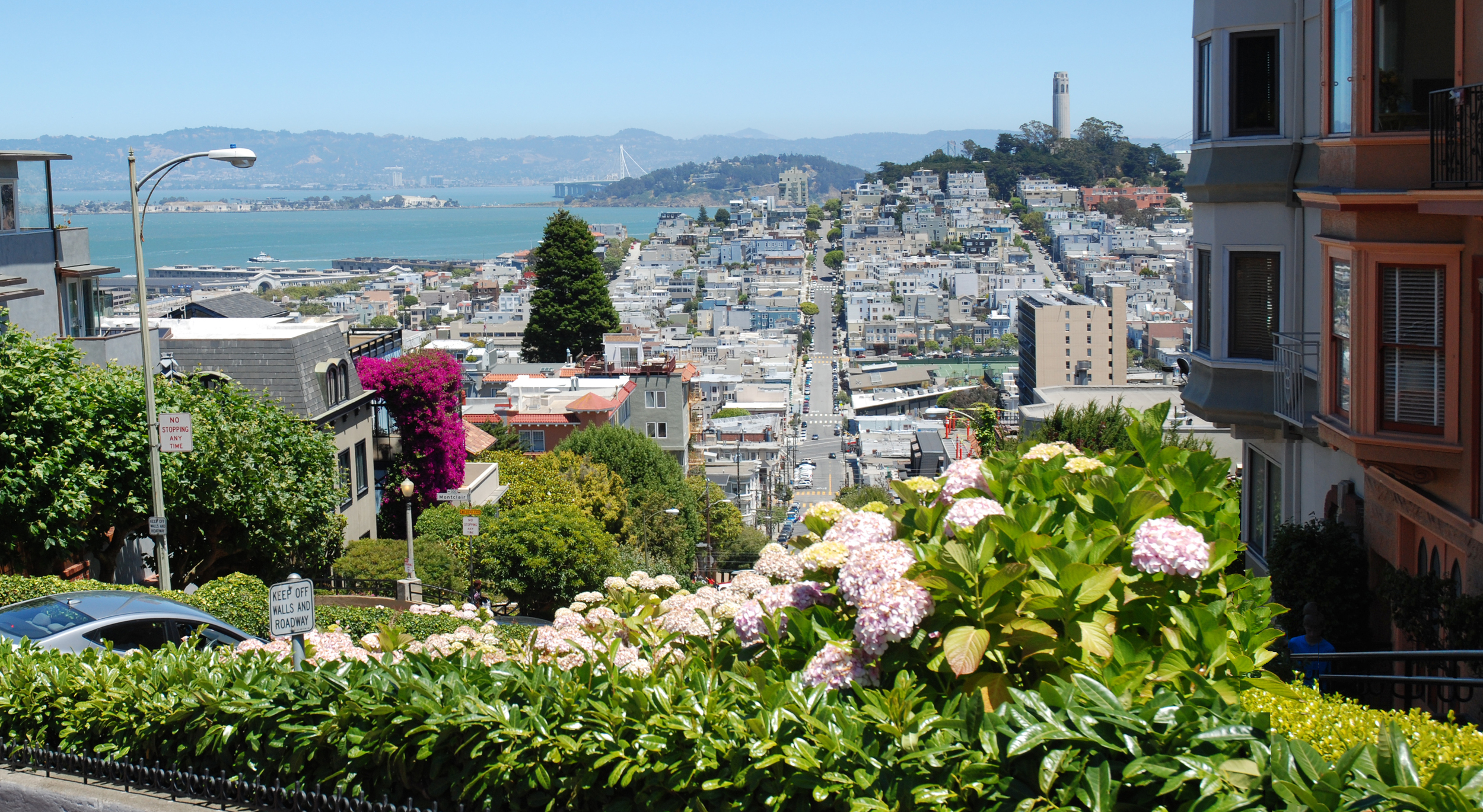
Now the chase jumps clear over to Russian Hill to where tourists regularly gather every day to take in the east view to Coit Tower from Lombard and Hyde at the top of the famous crooked street (map).
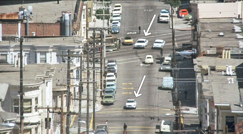
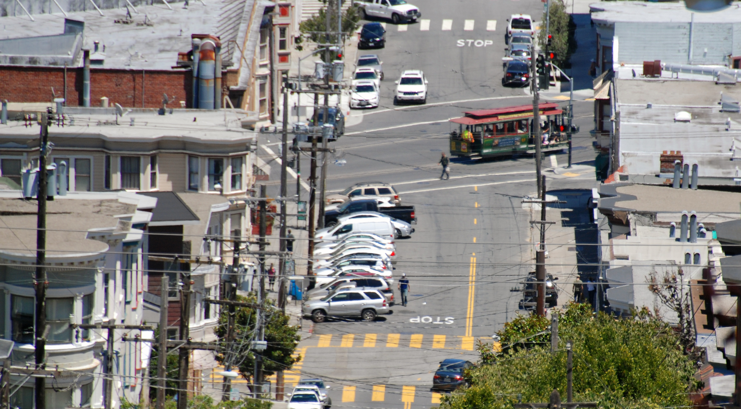
Not surprisingly they're not joining the procession down the eight switchbacks; instead this is a convenient vantage point from which the camera can zoom in to the two cars, arrowed, crossing Columbus Avenue (map). In the recent Now image a Powell-Mason cable car clangs by on Columbus.
The car chase ends when Camerero abandons his Mercedes in the middle of Union Street in North Beach and takes off on foot across Columbus with Jake in hot pursuit (map). This view looks west along Union rising up to Russian Hill.
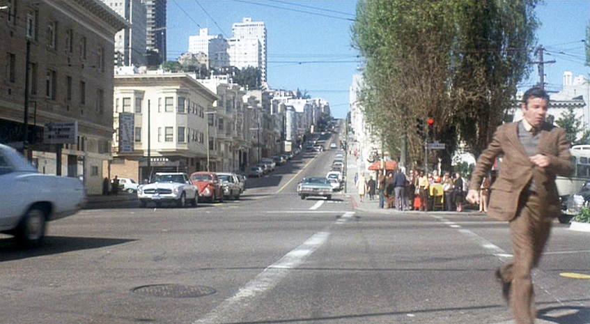
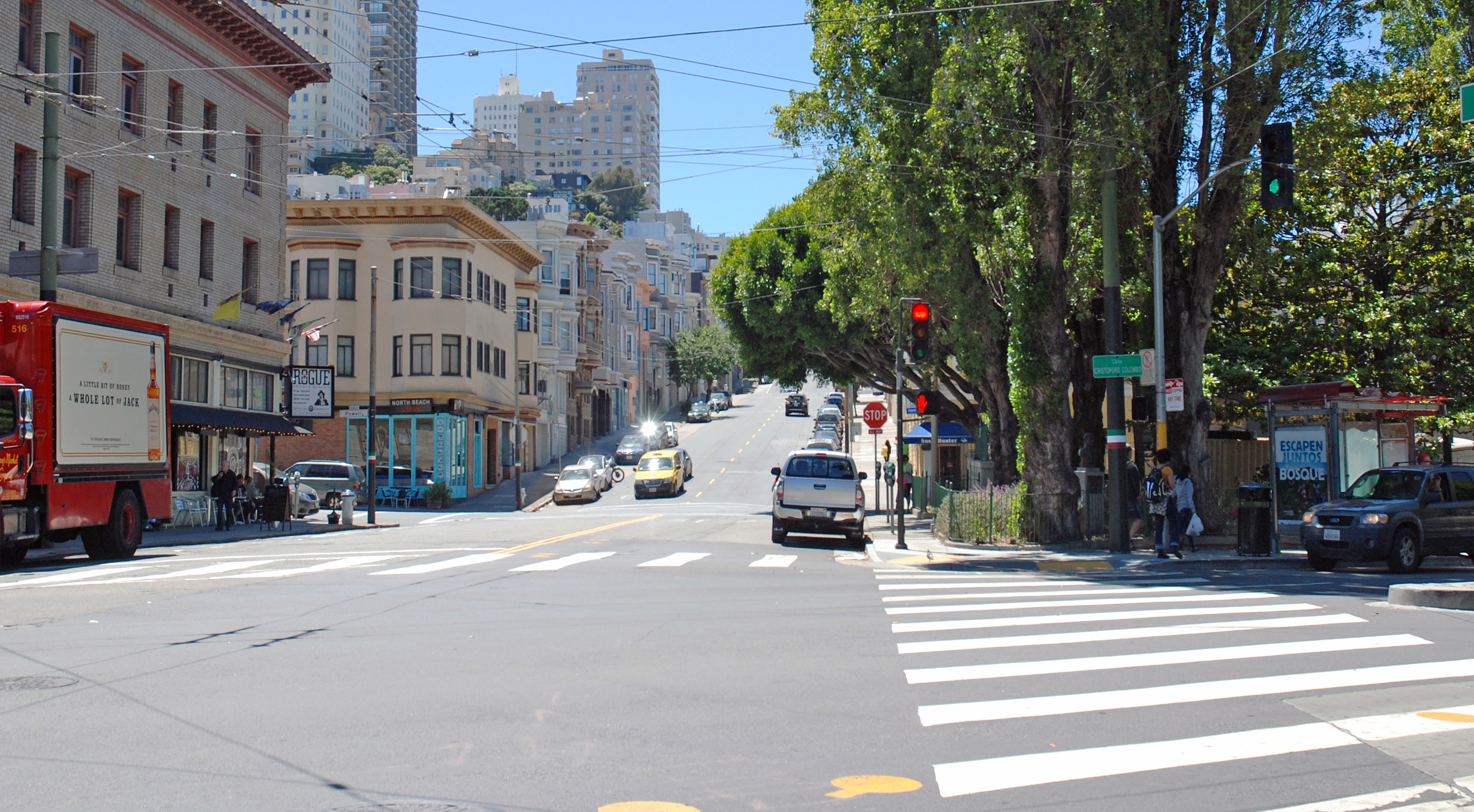
He spots Camerero boarding a Muni bus and runs across Washington Square Park in time to jump on at its next stop in front of Sts. Peter and Paul church (map). As he takes a seat with a clear view of Camerero the second phase of the pursuit - the bus chase - is about to begin.