The angry crowd continues its pursuit of Frisco Pete through Chinatown. Note, as he rounds this corner, the painted-out Anchor Steam beer ad on the wall; remember, the movie was filmed shortly after the Prohibition ban became effective nationwide, on January 19, 1920.
Then ... a wider view of the same corner is seen here as the crowd appears. The painted-out beer sign was on the wall of the Guide Saloon.
... and Now, this is Wentworth Place in Chinatown where it tees into Jackson Street (map). The corner store has since been expanded a few feet into Jackson below the overhang - today it's the traditional Chinese medicine store Wan Hua Co. at 665 Jackson - but the two side window openings on Wentworth set in the brick wall are still clearly visible even though they have been filled in. The building exteriors facing us on Jackson have been significantly changed.
Then ... Pete spots the amputee Blizzard crutching across Wentworth. Blizzard is his boss and right now the only hope he has. Wentworth Place had a notorious reputation back then - the row of businesses down the right (west) side all housed Chinese brothels.
... and Now, Wentworth Place today, resurfaced and with cleaned-up businesses, presents a colorful appearance. Note the matching windows and fire escape balconies on the 2nd and 3rd floors of the building facing on Washington Street.
Then ... Outside Blizzard's house Frisco Pete recounts his misdeed and beseeches his boss to help him out. Realizing that doing so will give him even more power over his wayward lackey, he lets him hide inside. Pete gets a reprieve - it's not what you know but who you know, just as important back then as it is today.
... and Now, today's entrance to Blizzard's house, 59 Wentworth Place, is behind the white wrought iron security door. The camera position is the same Then and Now but note that the sidewalk has since been widened, moving the lampposts outwards.
This 1913 Sanborn Insurance map shows the location of Blizzard's house. (Back then #55, today it's re-addressed as #59). Note the F.B. designation, Sanborn's abbreviation of 'Female Boarding', a euphemism for brothel. With 3 saloons, a restaurant and 13 brothels, Wentworth must have been a busy place at night.
Then ... Blizzard beckons to a passing cop ...
... and Now, the east side of Wentworth Place. The buildings facing us on Washington and most of those on Wentworth are the same as they were a hundred years ago except that the shopfronts have all been redone.
The criminal mastermind has the police force in his pocket and all it takes is a wink-wink to get the cop to go down and disperse the crowd.
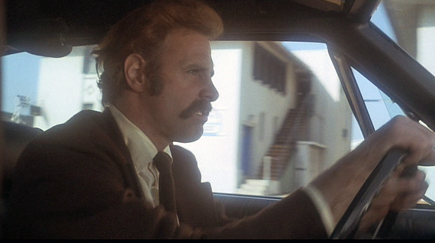
Then ... After planting the tree Maude drives Harold back over the Dumbarton Bridge along Highway 84. When she passes the same cop who she humiliated earlier he can't believe his luck and immediately gives chase.
... and Now, the same spot alongside a pylon on this now unused stretch of the highway (map) is seen here from the elevated causeway that replaced it.
Then ... he catches up and has to pound on the car to catch her attention. At the top of the hill is the toll plaza seen in their first encounter, viewed from the opposite direction.
... and Now, as explained in the preceding post the toll plaza has been moved to a rerouted section of Highway 84. Today this part of the original highway, Marshlands Road, is the access road to the Don Edwards San Francisco Bay National Wildlife Refuge.
Then ... Eventually Maude deigns to pull over, not far from the toll booth.
... and Now, that same roadside location (map).
Then ... The cop orders them out of the car but when the unsuspecting clod gets in to check it out, Maude beckons Harold to his motorbike, he hops on behind her and with a roar they zoom off past the toll booths.
... and Now, the same view today.
The final ignominy for the hapless cop? He takes a pot shot at them but his gun misfires.
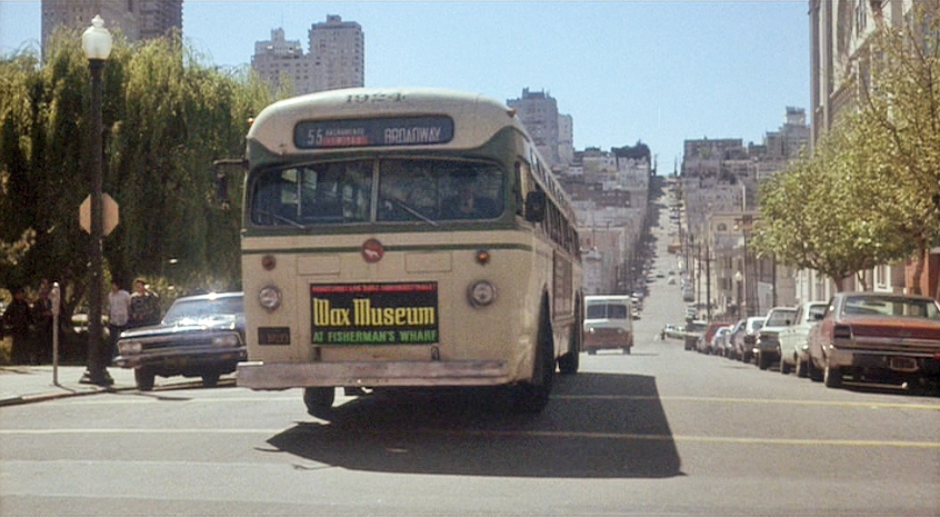
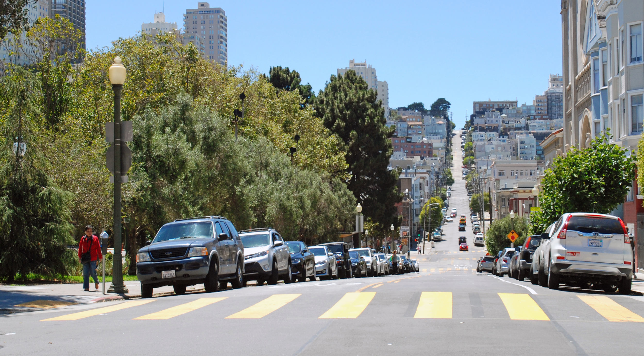
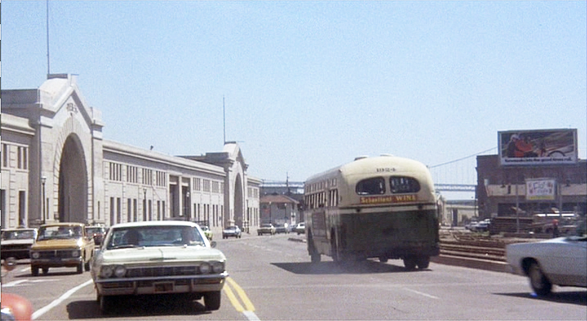
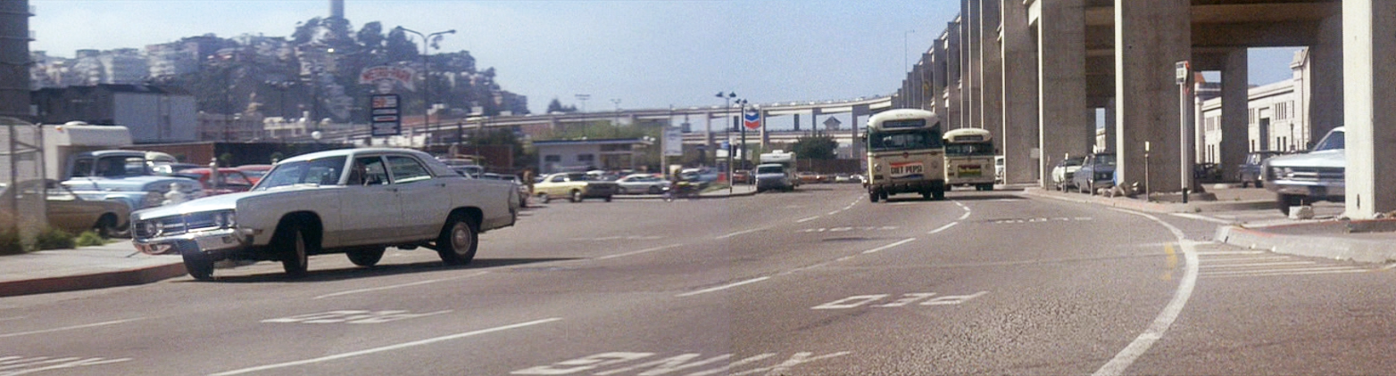
The 55 Broadway bus, carrying Jake and Camerero, passes Washington Square Park on the left and Saints Peter and Paul Church on the right (map), about to make a left from Filbert Street into Stockton Street (in real life there was no such bus line). Throughout the chase, click or tap the image or thumbnail to compare Then with Now.
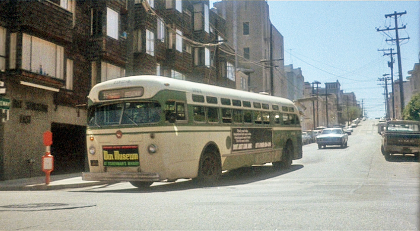
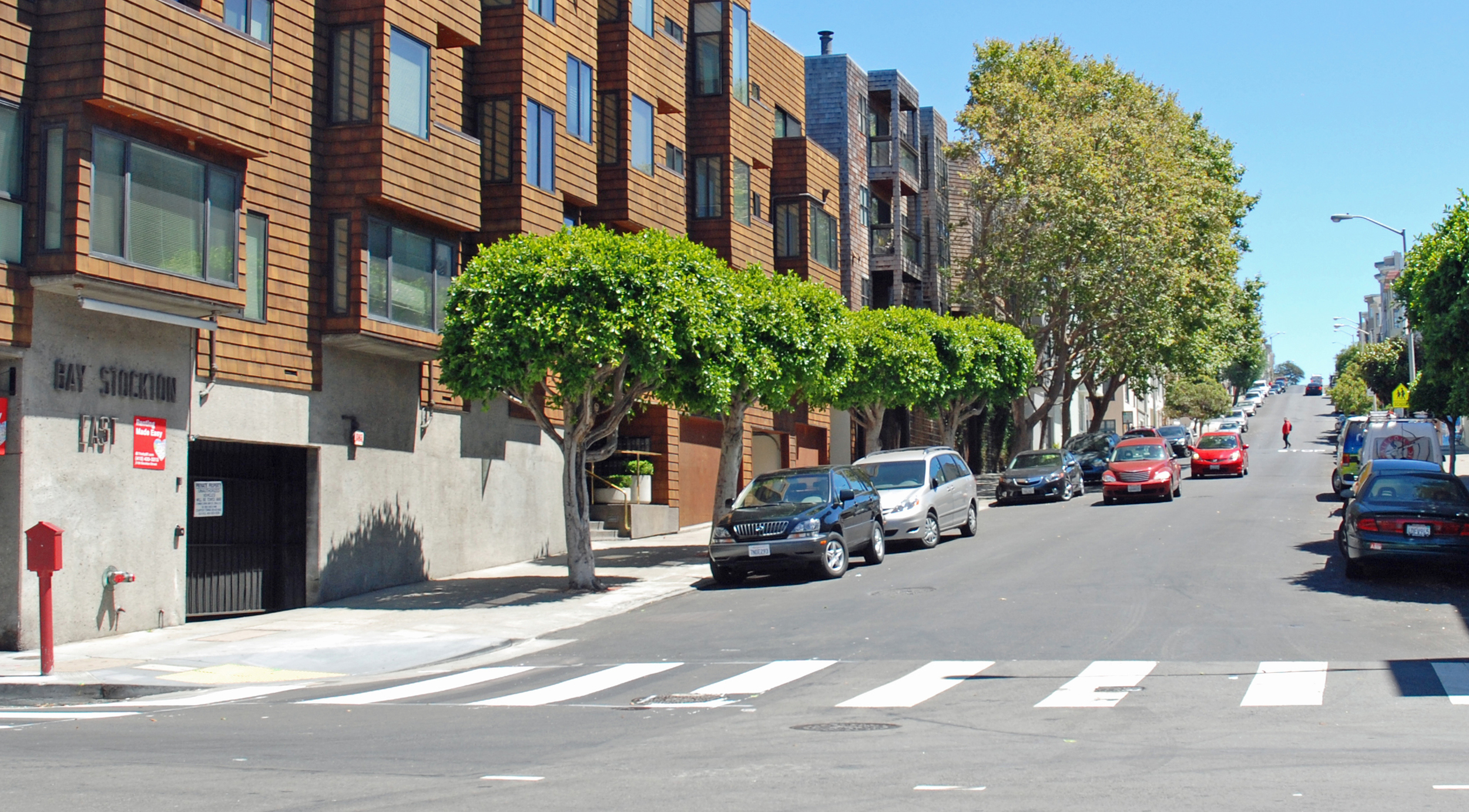
From Stockton the bus makes a right into Bay Street (map) with Larsen following in pursuit.
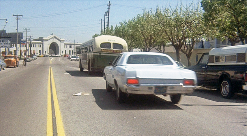
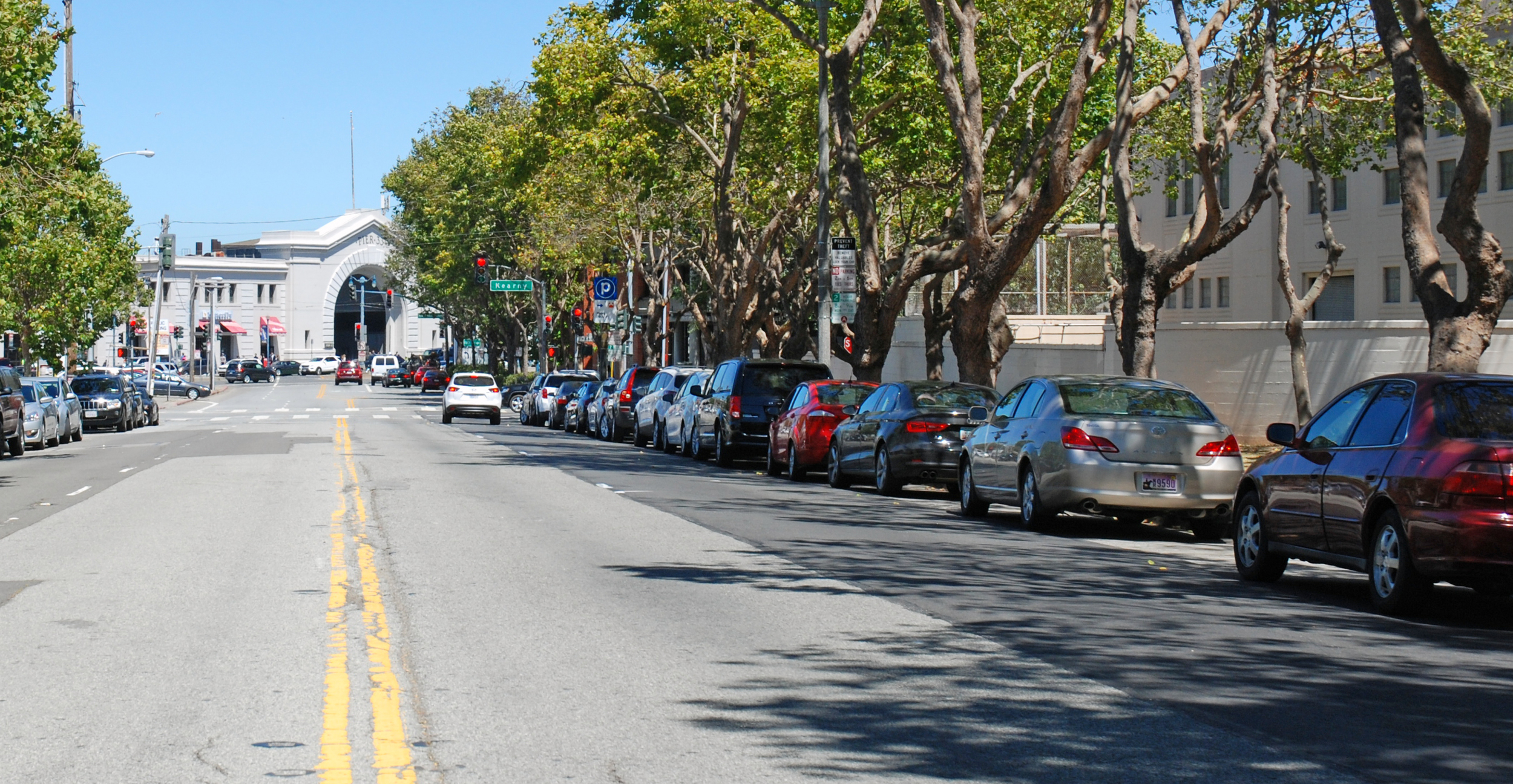
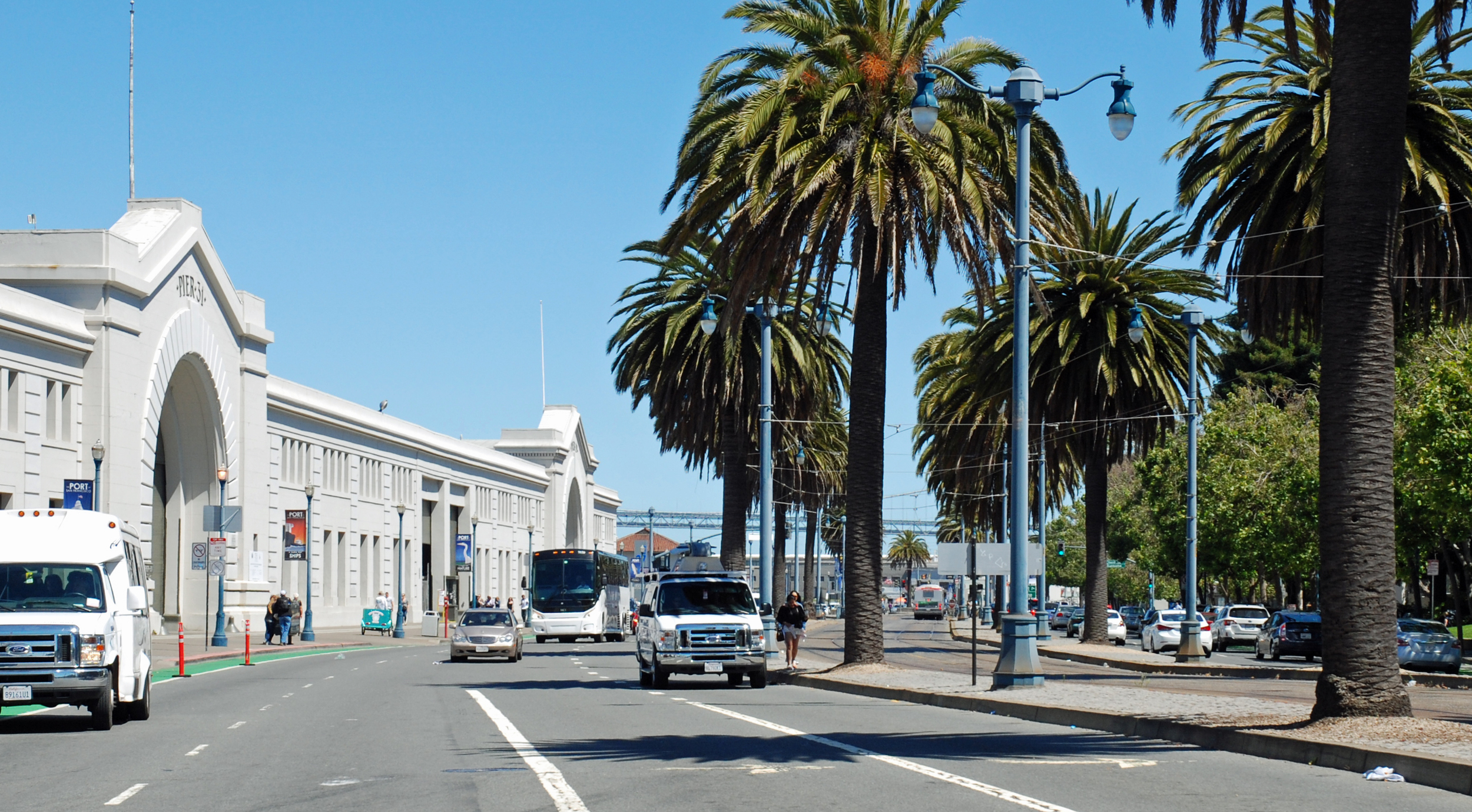
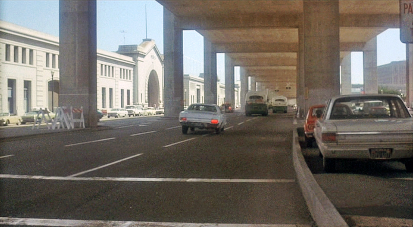
They continue along Bay towards Pier 33 on the Embarcadero.
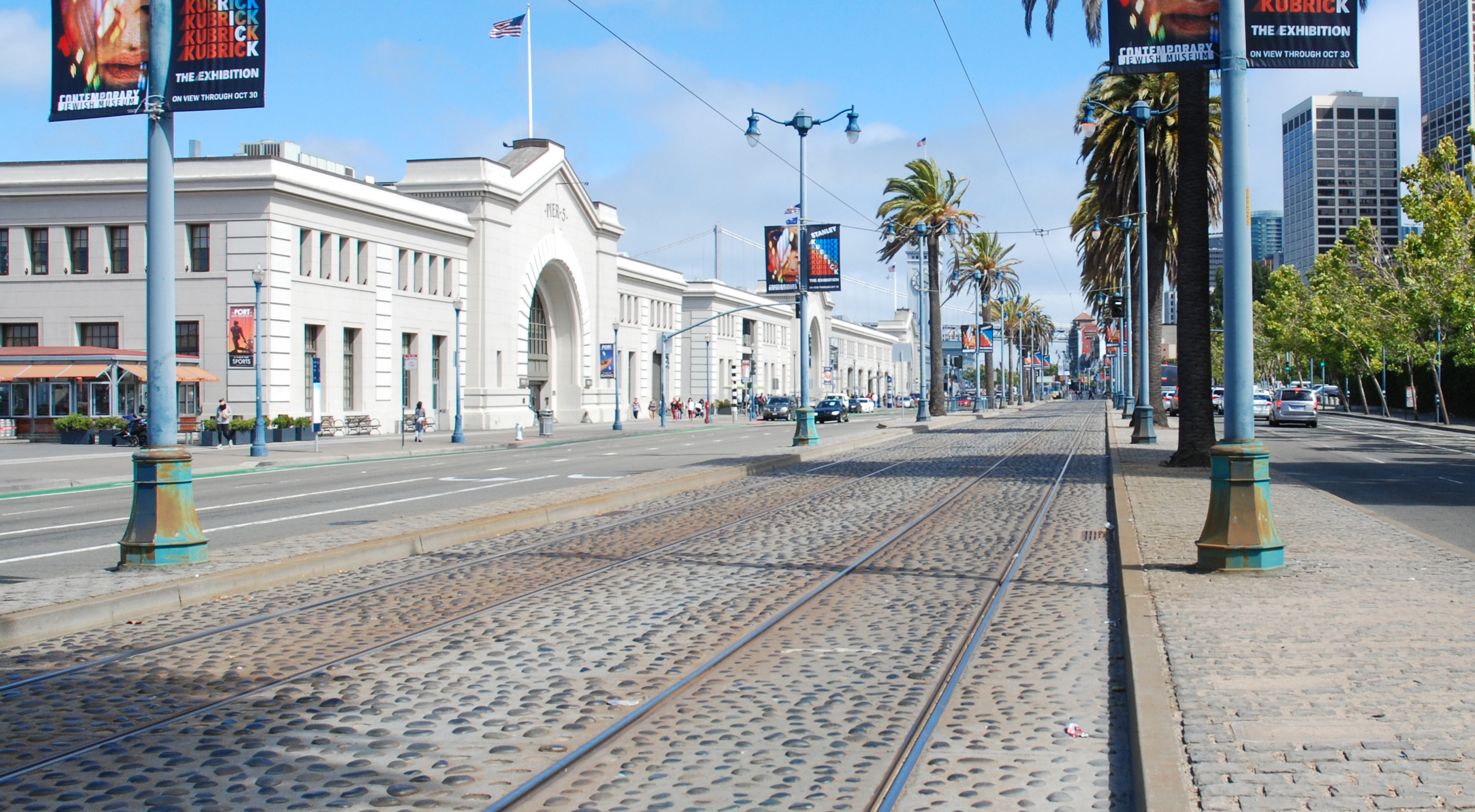
This bus sure goes a long way between stops - here it has turned south down the Embarcadero heading towards Piers 31 and 29 and that's the Bay Bridge in the distance. Today's Embarcadero is wider, with tram tracks and palm trees down the center.
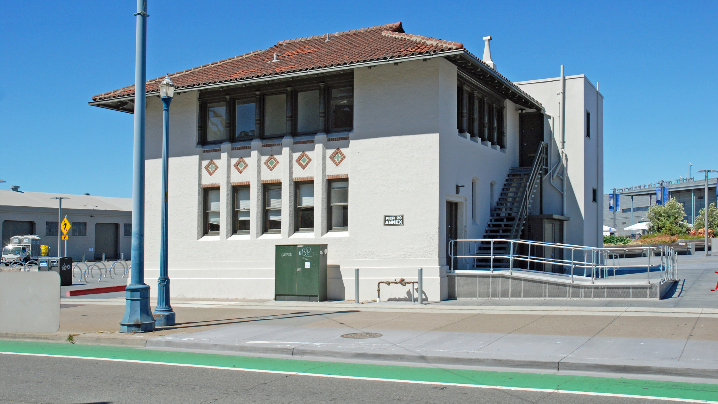
Larsen stays as close to the bus as he can. He's passing the Pier 29 annex, originally the administrative offices for the State Belt Railroad that used to haul goods along the length of the Embarcadero. While adjacent piers 25 and 27 have long since been demolished, that building remains as a lone survivor, now with an ADA-mandated ramp for the handicapped.
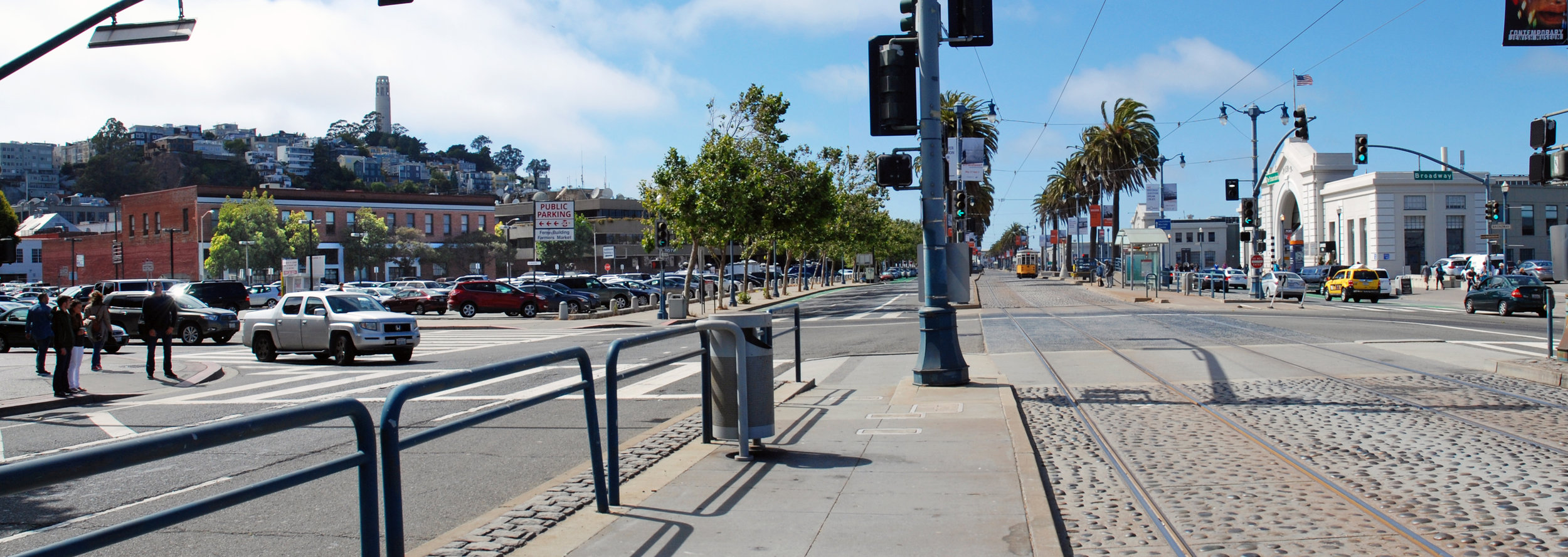
In his haste Larsen swerves, narrowly avoiding another car, before getting back on track. This view looks north along the Embarcadero past Pier 9 on the right. The north end of the Embarcadero Freeway swings left to the Broadway ramps but now the freeway is gone leaving a clear view of Coit Tower atop Telegraph Hill.
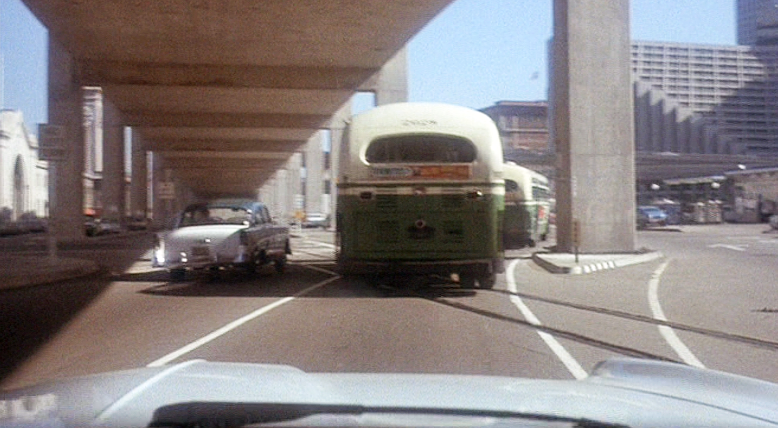
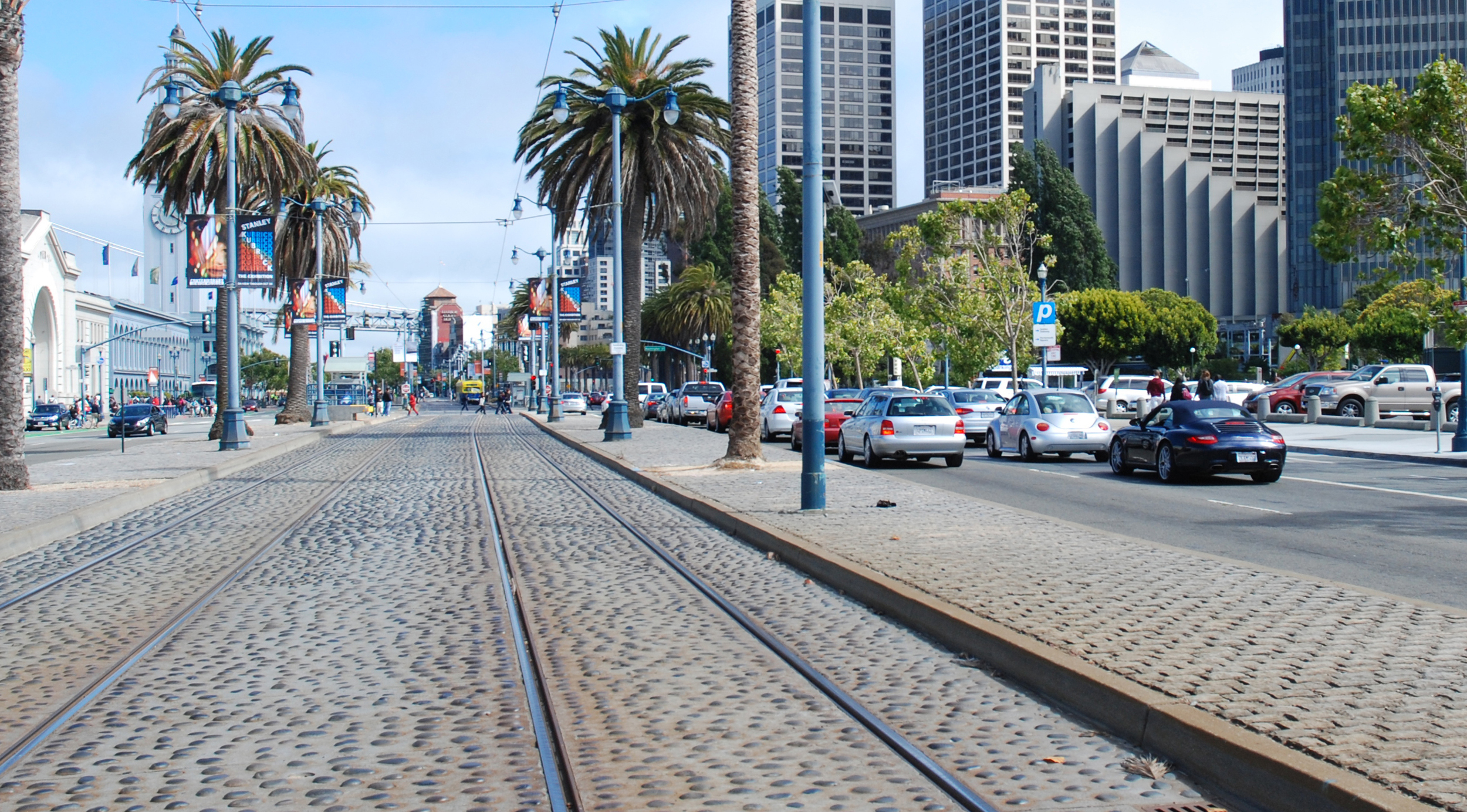
As they approach Pier 5 this shot shows why the Embarcadero Freeway was such a bad idea. The ugly structure isolated the waterfront piers and the Ferry Building a little further on from the rest of the city. Damage from the 1989 earthquake eventually led to the freeway's demise - the recent photo shows how opening up the area and adding tracks for the historic streetcar E and F lines has transformed the waterfront. It also shows that the Pier 5 bulkhead was modified after the adjacent Pier 7 (just out of view at far left in the Then photo) was removed.
Another bus gets in the way as they approach the Ferry Building on the left and the stylishly ramped Hyatt Regency hotel on the right. The hotel today is surrounded by newer Financial District high-rise office buildings.
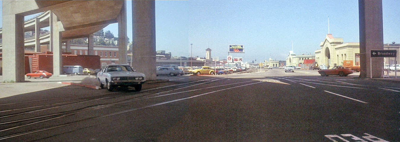
Looking back to the north towards the oncoming bus the end of the freeway at Broadway curves off in the distance. In the foreground Washington Street tees off to the left and there's a Chevron gas station further down, no longer there.
On the bus, Camerero has had enough. Just as he did at the start of the movie he opens his briefcase and furtively assembles his weapon. This can only end badly, will this be another bus massacre? The showdown must come.
CitySleuth is often asked how he finds his locations, especially those that have completely changed or vanished since they were originally filmed. This next location is a good example and he will use it to describe the process that identified it. Although his conclusion is not absolutely 100% verified, he is quite persuaded. You decide.
Then ... Frisco Pete is in big trouble. He has just committed a murder and he's being chased through Chinatown by an angry horde. Here, he pauses next to the New Chow Chong Cigar Factory, one of dozens if not hundreds in Chinatown back then. There are quite a few clues in this brief clip: the street number (15), business name and an adjoining passage behind the fugitive leading through to the next street or alley.
... and Now, CitySleuth has concluded that this was 15 Jason Court, formerly named West Court and before that Sullivan's Alley, a very narrow alley off Jackson Street (map). Here it is today.
So what led CitySleuth here? A search of city directories from the year of filming, 1920, contained no reference to the New Chow Chong Cigar Factory No. 101. This however was no surprise - many of Chinatown's small businesses avoided contact and cooperation with city official's attempts at documenting them. There were some Chinese language directories but few have survived, not to mention the translation problem. The number 101 assigned to the Cigar Factory suggests it was part of an organized trade listing but all efforts to find this have been fruitless. Public library records and the Chinese Historical Society on Clay Street were consulted but were no help; those who would have known are long departed.
The first break came from an internet search revealing this entry in a 1905 Chinatown residential directory:
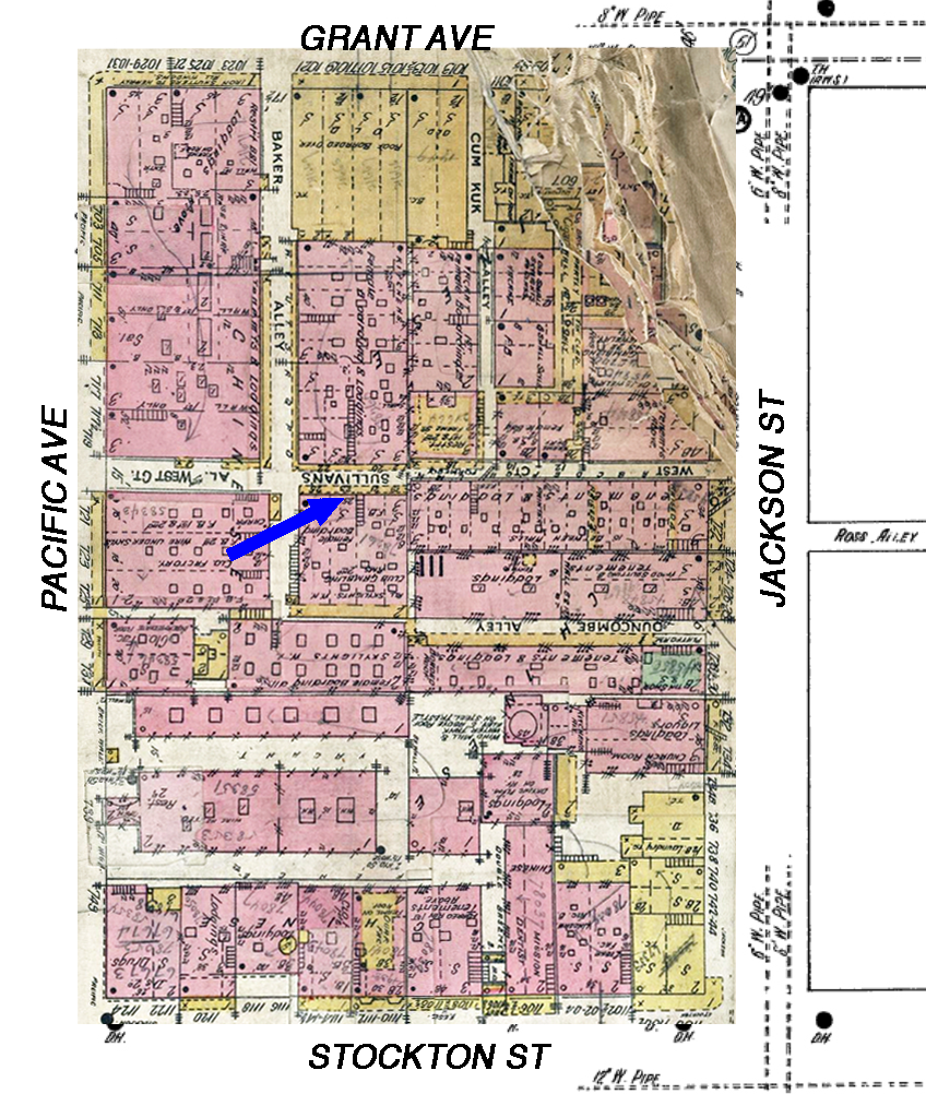
1905 preceded by one year the earthquake and fire which razed Chinatown. Could the 'New' Chow Chong Cigar Factory have been a rebuild of this business after the fire? And where was 23 Sullivan Alley exactly? CitySleuth then came across a remarkably detailed 1905 David Rumsey fire insurance map book which survived fire damage and yielded the answer. The arrow points to # 23, part of a building of multiple small stores, a gambling club and 'female boarding' (the quaint euphemism back then for a whorehouse). Note that the alley in 1905 was called West Court, but marked as 'formerly Sullivan's Alley'. It traversed the entire block from Jackson to Pacific. Grant Avenue, then called Dupont Street, crosses at the bottom (click on the image to enlarge it).
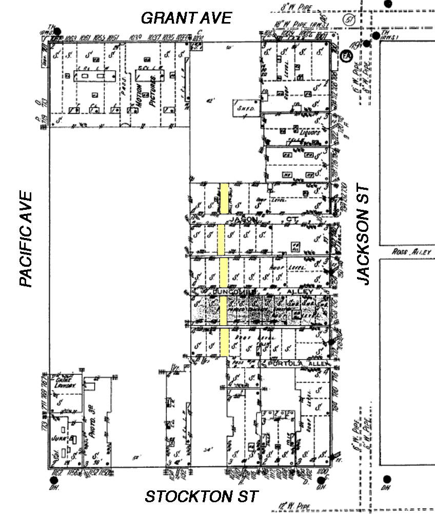
After the fire Chinatown was totally rebuilt including, by 1913, about 3/4 of this block, shown below on a Sanborn fire insurance map (note that the orientation is rotated 180 degrees compared to the above 1905 map). Sullivan's Alley has been renamed Jason Court, becoming a dead end alley only half as long as it used to be. No doubt as a reaction to the fire, several ground-level passages (highlighted in yellow) were constructed as an evacuation route. Click or tap the image to toggle to an aligned overlay of the 1905 pre-fire block. The original cigar factory location is indicated by the blue arrow - it shows that it was not located in the surviving Jason Court.
Here's a closer look. The blue lines indicate where the alley extension used to run (in 1913 this area was an open lot; today it's part of the Ping Yuen Public Housing project); again the blue arrow points to where the Chow Chong factory was in 1905. Note that in 1913 #15 Jason Court (black arrow) is alongside one of the passages, like in the movie. What's more, if you look carefully at the movie image (at the start of this blog post) you can see from the brick walls on either side that the camera had been set up across from the cigar factory in yet another passage - CitySleuth surmises it was at the spot marked by the red cross. The passages offer strong evidence supporting 15 Jason Court as the new site for the burned-down original.
But here's the clincher - Note that the foundation level of the shop was slightly higher than that of the adjoining passage. 96 years later, 15 Jason Court is exactly the same. Quod Erat Demonstrandum. Anal is as anal does.
Jason Court today, viewed from Jackson Street, has hardly changed since the post earthquake rebuild. #15 is on the left near the end of the alley. The connecting passages have long since been converted to shops and businesses; every square inch is precious in San Francisco's precious Chinatown.