Harold And Maude - Maude's Rail Car
Maude's home is rather unusual, to say the least. She lives in a Pullman railroad car. There were many scenes filmed at the car from which CitySleuth chose examples for this post, revealing the location, and the next post, focusing on the interior.
Here's an undated photo of the railcar used in the movie. Originally built by Pullman in 1913 as a sleeper, it was converted in 1931 to a buffet lounge car and given the number 653. For the next 34 years it saw service with Western Pacific until being retired in 1965 - for a time it was part of the Exposition Flyer that ran between Chicago and Oakland via the Sierra Nevada mountains by way of the Feather River Valley. It was acquired in 1966 by the Western Railway Museum in Solano County, California (map) where it is still on display. The moviemakers leased it from the museum and transported it by rail to the end of a spur line in South San Francisco for the filming.
Then ... Harold's hearse-ified Jaguar is parked alongside the railcar on the north side of Oyster Point Boulevard, South San Francisco, between Eccles Avenue and Gull Drive (map). An added covered patio serves as a convenient entry.
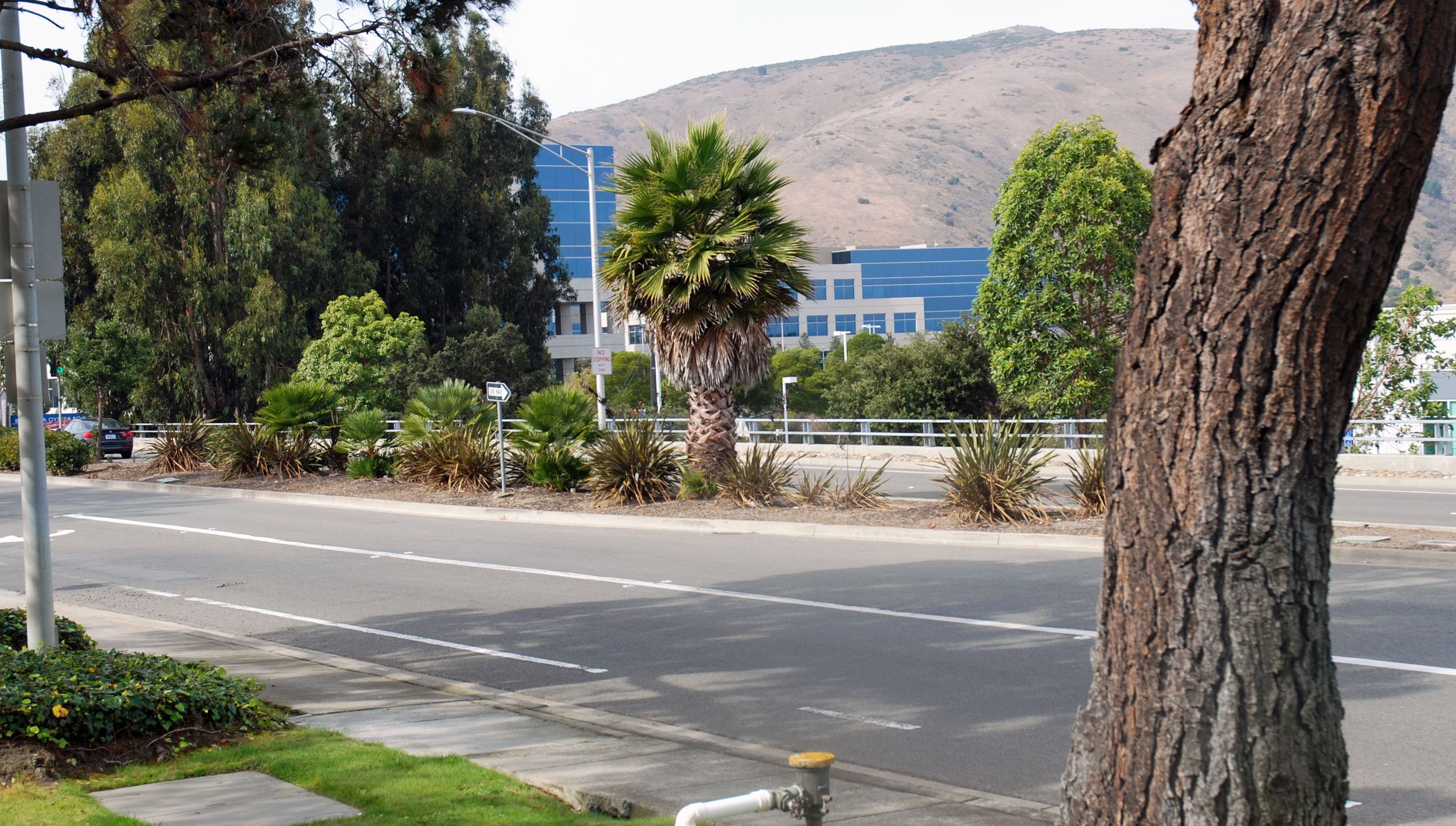
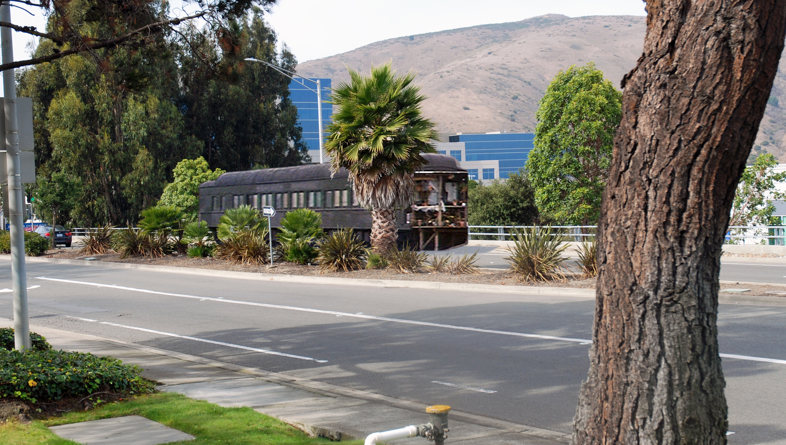
... and Now, Oyster Point Boulevard was previously named Butler Road; the roadside spur line was removed when the road was widened into a divided highway and renamed. What if the railcar could be returned to the same spot? ... click to bring it back.
Then ... CitySleuth was able to estimate the railcar site by triangulation from two of the exterior shots. First, as Maude is helped up to the patio we see, across the street, a building which is still there.
... and Now, the same building, viewed from today's median.
Then ... And second, to the left of that building, across from Maude's mailbox, there's a hydrant and an empty lot.
... and Now, an office building has since been built on the lot but the hydrant is at or very close to the same place, serving as a point of reference.
The roadside rail spur is shown on this USGS map: rail tracks and buildings that were there in 1956 are shown in black. Added structures as of 1979 are shown in purple, including both buildings described above across the road from the arrow pointing to where the railcar was.
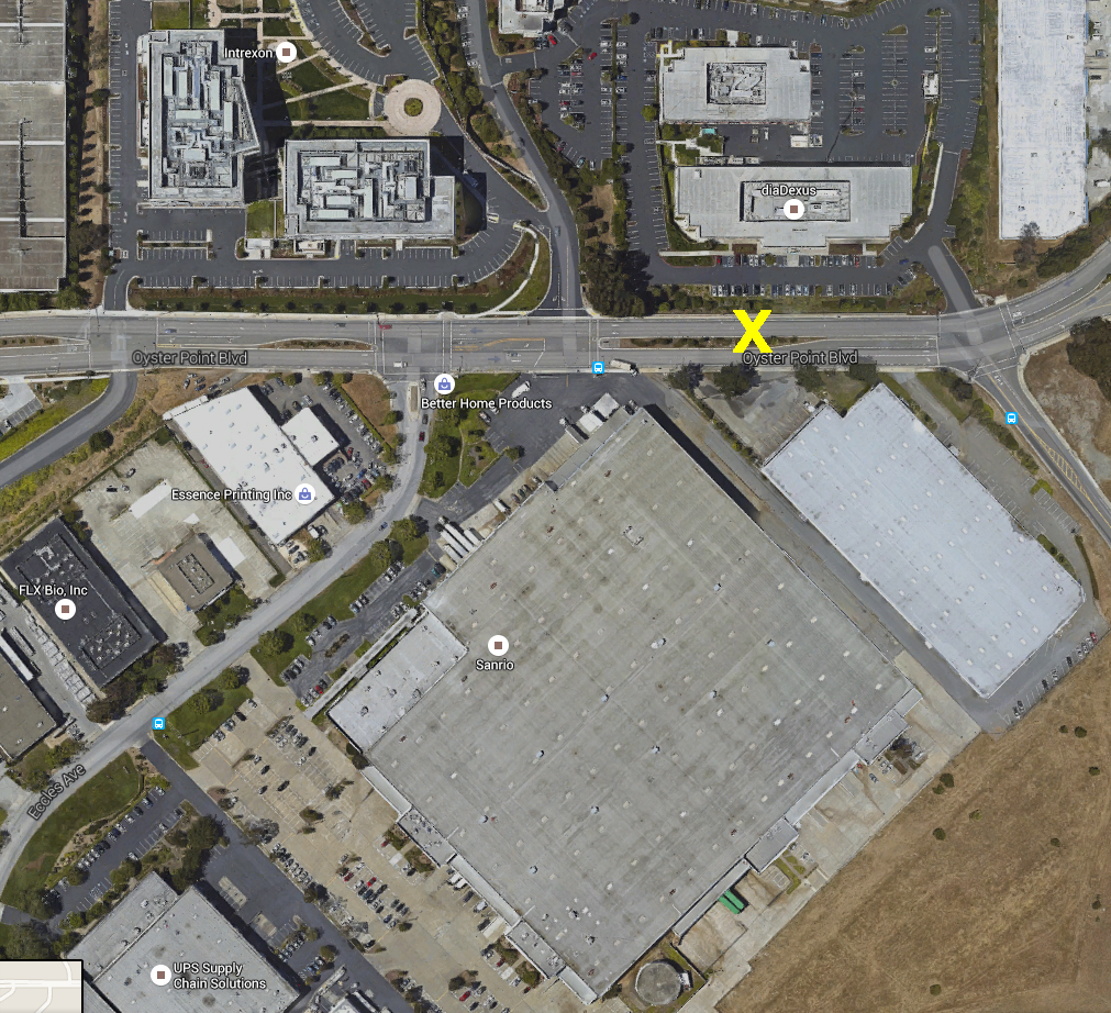
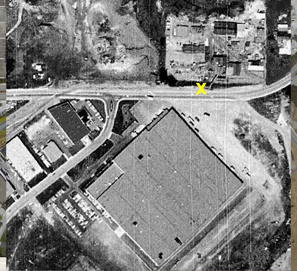
CitySleuth also created this aerial overlay of Then (a 1968 image) and Now (a Google Earth Image) of the railcar location. Click the image to toggle between 1968 and Now. X marks the spot.
Then ... When Harold drives away from the railcar (it's on the right), the railroad crossing ahead is for the spur line track where it crosses the road as shown on the map above.
... and Now, no tracks cross today so there are no crossing signs - they would have been just past the Eccles Avenue junction. The building at far left across the median is the same as the one above, and new offices - the green building - have since been built next to it.


