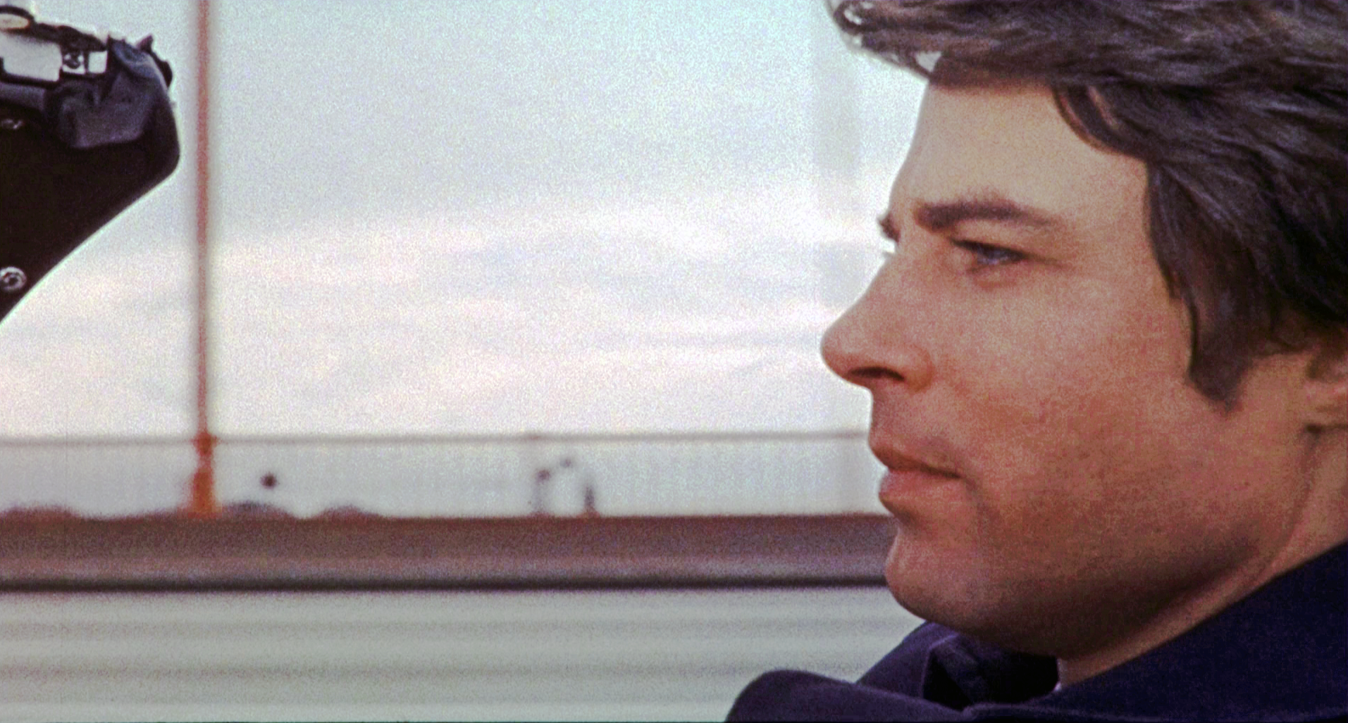
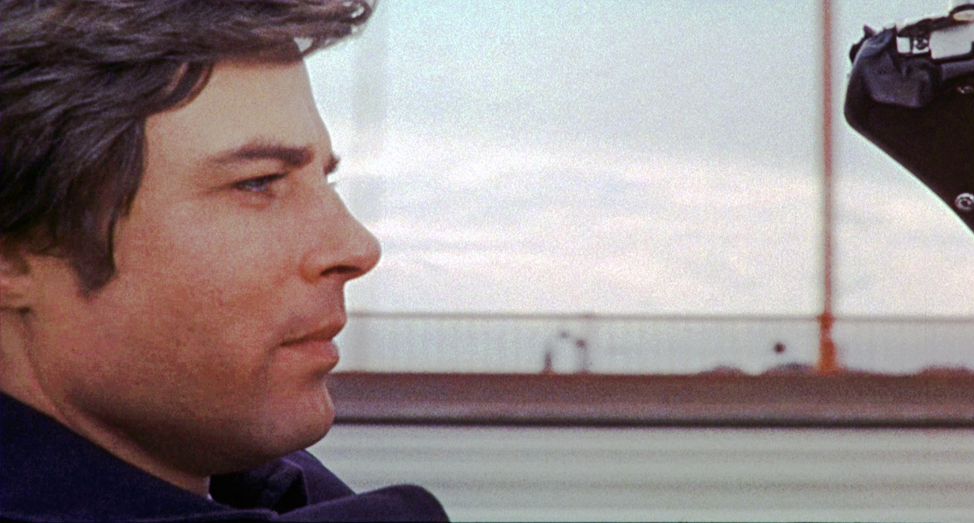
Then … After parting ways with Jane at the Southern Pacific depot George isn’t ready to give up on her. He pulls into a Union 76 gas station to ask for directions to San Luis Obispo.
… and Now, this gas station was located opposite Grace Cathedral on the corner of California and Jones (map); it was replaced in 1972 by the Gramercy Towers condominiums. Along California where Mason Street crosses you can see the brownstone Pacific Union Club where Scottie Ferguson met with the scheming Gavin Elster in Hitchcock’s classic Vertigo. Incidentally, a scene in Bullitt filmed at the cathedral included views of the club and the gas station.
Then … Armed with the vaguest of directions …”You have to go ‘round the other way”, he heads south, a good start given that San Luis Opispo is 230 miles south of San Francisco.
… and Now, in this recent shot of Jones viewed from California most buildings are unchanged except for Gramercy Towers occupying most of the block on the left.
Then … We next see a series of overheads of George racing south intent on arriving before the train does. As is often the case in movies the locations are anything but sequential. In this aerial a Southern Pacific train passes under a freeway overpass whose center lanes were still under construction (in 1969).
… and Now, CitySleuth is grateful for reader Notcom (see his comments below) for identifying the various locations of the aerial shots of the train seen in this post. This one is where Highway 101 crosses the Caltrain line at Sierra Point near Brisbane (map). Note the walls beneath the overpass that create a protected corridor for the passing trains, visible in both Then and Now images. The construction work above expanded the overpass from six to eight lanes. This line does indeed lead to San Luis Obispo except the train above happens to be heading north to San Francisco.
Next we see George’s ‘Vette following the railroad tracks past a series of orchards, part of California’s agricultural industry made up of thousands of such small farms. Most of the Bay Area’s orchards have long since been gobbled up by housing for the growing population.
Then … This aerial (a different train!) captures an expressway overpass in a suburban town.
… and Now, this is the CalTrain line passing under the Woodside Road (Highway 84) overpass near Middlefield Road in Redwood City, 25 miles south of San Francisco (map). Once again the train above is heading north to San Francisco.
Then … Now George is crossing a bridge … but where is this? The answer is revealed by the distant rock formation seen through the railing: the rocks at Point Bonita (map), so he’s on the Golden Gate Bridge, way north of his intended route. But kudos if you noticed something odd here, because, given that Point Bonita is to the west of the bridge he appears to be driving in the wrong direction. Click or tap the image to revert him to the real world.
The film editor had flipped this footage to fool the audience because he had used it in an earlier scene in the movie - see below. At this spot on the bridge the rocks, and a part of the Marin Headlands, are clearly seen. Reusing this clip though was a continuity goof because he’s wearing a dark overcoat whereas he had on a plaid overcoat when he started his trip (and as we will see, when he arrives at his destination).
… and Now, here’s the same view today from the slightly higher vantage point of the Google Street View’s roof-mounted camera. Today’s image also shows the moveable center barrier in the foreground that was installed in 2015; another addition is the pedestrian walkway railing for protection from passing cars that blends in seamlessly with the bridge’s design.
… and Now, this beautiful view of the bridge looks back from above Point Bonita. The Marin Headlands are on the left; the city spreads out on the right like Xanadu-on-the-bay. The lighthouse at the tip of the point is a popular hiking destination.
Then … Now he has caught up with the train, the same as the one first seen 6 images above.
… and Now, we are now in Burlingame, 16 miles south of San Francisco. The T-junction at top left is Toyon Drive and Carolan Avenue (map). But, oops, George needs once again to be told that this train is heading north, not south.
Then … What the …? He’s back in San Francisco driving along Auto Row past the Reynolds-Seiler Toyota dealer at 1465 Van Ness Avenue on the southwest corner of Pine Street; he then passes a Standard gas station across Pine (map). But in a repeat of the earlier continuity goof he is again wearing the dark overcoat.
… and Now, that block where the dealer was fell prey to the San Francisco Towers, a 250 unit senior living community complex and street level retail stores. The construction mess on Van Ness is the result of an ongoing upgrade of the thoroughfare to add dedicated bus lanes - observing its multi-year progress is, to residents, like watching grass grow. But the gas station is still there across Pine Street, and (interesting trivia) it’s a unique one - it’s the sole remaining Standard station in California. Intrigued? Read about it here.
He continues following that same train. The Johnson’s Wax building is a clue to this location.
Then … Next we see him on a bridge over a large body of water.
… and Now, Back in the Bay Area, again way north of his supposed route, he was traveling east to west on the steep rise to the elevated section of the San Mateo Bridge that spans San Francisco Bay from Foster City to Hayward (map). The arrow marks where he was in the above shot.
And finally he arrives at his destination, San Luis Obispo’s Southern Pacific depot. Or is it? And does he beat the train? Don’t miss the next post for the answers!
Then … The killer has threatened to kill one person a day until his ransom is paid. He had struck from a rooftop the first time so the police department posted armed lookouts on rooftops around the city and dispatched a helicopter to survey from above. The panorama below, filmed from a tall building in Russian Hill, looks to the north and spans the Golden Gate Bridge on the left to Alcatraz on the right.
… and Now, CitySleuth was able to access the same rooftop to be able to match the panorama as it looks today, … mostly identical but a breakwater has been added at Hyde Street Pier and Pier 45 at far right..
The camera’s vantage point was the roof of Bellaire Tower, pictured in a recent photo below. Built in 1930, the elegant pencil-thin condominium at 1101 Green Street (map) was designed by H.C. Baumann, a prolific San Francisco architect who designed over 400 apartment buildings and hotels.
The helicopter then flies past more police lookouts positioned atop Bellaire Tower. The building seen through the antenna at far right is The Summit at 999 Green Street, another swanky residential high-rise. Built in 1965, this Joseph Eichler project had a modern exterior design - lots of glass and balconies - but lacking the class of Bellaire Tower.
Then … The helicopter banks towards downtown in a shot that shows 999 Green more clearly on the left. The tall building at far right is the Bank Of America Center from whose roof the killer had first struck.
… and Now, downtown today is far more crowded. The TransAmerica pyramid clearly visible below was under construction at the time of the fly-by. When completed it was the tallest building in the city until being surpassed in 2018 by the bullet-shaped Salesforce Tower.
If for no other reason than it’s a lovely photo, check out this north-facing view of the Russian Hill high-rises showing The Summit in the center and Bellaire Tower on the left.
Then … The helicopter lands on a rooftop to check in with Harry Callahan. The nearby red sign reading ‘BM&T Paper’ belonged to the 870 Brannan Street headquarters of Blake Moffit & Towne Wholesale Paper Distributors - it provided the clue to this location: this is the helipad on the roof of the Hall Of Justice at 850 Bryant Street in the SoMa district.
The helicopter takes off and Callahan descends into the Police headquarters.
… and Now, here’s a recent aerial shot of The Hall Of Justice; the helipad is still there but no longer used after the SFPD Aero Squadron was disbanded in part because of fatal crashes. On the left Highway 80 runs past the curvilinear County Jail.
Then … The helicopter swings by a couple more lookouts - this one is on the roof of 1080 Chestnut in Russian Hill. Above it are the Municipal and Hyde Street Piers.
Then … And here’s another atop the Fontana East Condominiums at 1000 North Point, also in Russian Hill. That’s Aquatic Park on the left.
… and Now, this recent aerial view captures both of those buildings - the yellow arrow points to 1080 Chestnut and the white arrow to 1000 North Point. Fort Mason is in the upper left corner and Fisherman’s Wharf is over to the right.
Then … the movie begins with a view of the San Francisco skyline seen from the top deck of the ferry boat Santa Clara.
… and Now, the skyline today is a huddle of modern buildings recently subserviated by the Salesforce Tower, aptly named - its 61 floors tower over everything around it.
The Santa Clara, launched in 1915, ferried passengers between San Francisco and Oakland - here’s a fun vintage image of passengers waving goodbye as it pulls out from the Ferry Building. The ferry’s tenure was not without excitement - at different times it suffered a fire in the engine room and a collision on the bay.
Then … In the wheelhouse the captain is reading out the news about famed local defense attorney Perry Mason’s closing plea to the jury in his latest murder trial. The Bay Bridge behind them is still under construction - the towers and massive central concrete caisson are approaching completion but the roadways are yet to be built.
This aerial photo taken early in 1935 pictures the bridge at about the time the movie footage, above, was filmed. ‘X’ marks where the ferry would have been. The photo also shows in the foreground the partial excavation for the tunnel through Yerba Buena Island that connects the bridge’s western and eastern spans.
… and Now, this recent photo taken near the same spot but closer to the caisson captured the bridge in similar alignment.
Then … Next, in front of a line of seafood stalls on Fishermen’s Wharf (map), newspaper vendors are trumpeting how Mason has defeated the D.A. yet again, winning his latest case. Italian immigrant fishermen started selling their daily catch at makeshift stalls here a century ago and have remained, generation after generation, ever since. Pictured here, from left to right, are stall #2 - Frank and Antonio Cresci Brothers, stall #3 - Antone Sabella (that’s Nino Sabella in front, leaning forward), and stall #4 - L. Rafello Fish Market.
… and Now, Those three stalls today are now two: The Crab Station and Sabella & LaTorre. The Sabellas sold to the LaTorre family after WW2 and they have taken over the Rafello space.
Then … The camera follows the newspaper vendors past the Rafello Fish Market - next to it is stall #5 - the name on the window is Tom, Tom & Joe’s Light House.
… and Now, #5 has retained the Light House name to this day, currently Nick’s Lighthouse.
This vintage 1950s photograph shows all of the stalls on this block. The visible signs extend from #1, the Excelsior Fish Market at far left on the corner of Jefferson Street (now Guardino’s), past Sabella-LaTorre, the Lighthouse, Alioto’s and on to #9 at the far end, Fishermen’s Grotto.
In front of the Light House the man of the moment himself, Perry Mason (Warren William) along with his good buddy city coroner Wilbur Strong (Olin Howard), points out his choice of fresh crabs for a planned evening meal with friends. With them is Mason’s man Friday Spudsy Drake (Allen Jenkins).
There’s another woman in George’s life: fashionista photographer Jane Bleeker (Italian actress Elsa Martinelli), introduced to us by way of an artistically filmed tête-à-tête accompanied by evocative music by composer Riz Ortolani. You can hear it here, between time points 2:22 - 4:44 on the movie soundtrack.
The action takes place on the mezzanine level in her studio. This, as were the other interior scenes in the movie, was filmed in Italy at the Cinecittà Studios in Rome.
It’s not hard to understand how he would be attracted to such a fashionista. But Jane then surprises him by announcing she is leaving San Francisco - even though she’s in love with him she wants … “a man on my own, I’m the selfish type”. She has already sold her business interest and bought a train ticket to San Luis Obispo.
Then … He offers to drive her to the station … they walk to his car from her place (1083 Lombard, the house at far right), near the top of Lombard Street’s famed ‘Crooked Street” block in the Russian Hill neighborhood (map). This was the setting for her spacious studio - unrealistic at such a residential property. But hey, it’s all about the views.
… and Now, new paint jobs aside, this block, a magnet for tourists, has not seen much change. In the distance Coit Tower presides over Telegraph Hill and beyond that there’s a clear view of the Bay Bridge and the hills of the east bay. (Incidentally, Jack Palance’s character’s apartment in the 1952 movie Sudden Fear was in the grey building next to Jane’s place).
Then … They drive off, pictured here between the fourth and fifth of eight hairpin bends.
… and Now, again, unchanged. The serpentine road was the city planners’ solution in 1922 to an otherwise dangerously steep slope for vehicles.
Then … Driving up Hyde Street, George looks for clarification … “Leaving me, or running away?”
… and Now, the cable car tracks head then and now down Hyde Street and across North Point (map) towards Hyde Street Pier at the bottom of the hill where our eyes are drawn to the distant Alcatraz and Angel Islands.
Then … Locationally unrealistic - now they are driving back into the city across the Golden Gate Bridge! The headlands of Marin County are in the background on the left.
… and Now, two notable safety changes have since been installed: a barrier has been added on each side of the roadway to protect pedestrians and cyclists from the dangerously close traffic whizzing by, and a central divider, repositionable to accommodate changing daily commuter flows, now protects drivers from head-ons. Suicide jumping wasn’t the only bridge hazard it seems.
Then … They arrive at the Southern Pacific depot. The Mission Revival structure was built here at 3rd and Townsend in the Mission Bay neighborhood in 1915 (map).
… and Now, the depot was demolished in 1976 after an architecturally mundane replacement was built a block south, in part to eliminate 4th Street traffic-crossing delays behind the original depot. This modern building took its place.
Then … Jane prefers that they part on the street … “I hate those tearful farewells on railway platforms”. Across 3rd Street behind George’s wistful gaze we see one of the bay area’s Doggie Diner fast food restaurants.
… 1n 1975 … here’s a vintage photo of the depot and the restaurant with its pole mounted giant dachshund head mascot sign - from the rear we see its floppy ears and chef’s hat.
… and Now, The Doggie Diner chain eventually was gobbled up by the competition and all of its San Francisco restaurants are gone; one vestige remains however - preserved by nostalgists is a transplanted lone mascot pole sign on the median near the San Francisco Zoo on Sloat Blvd at 45th Avenue (map).
Then … Jane, stylishly caped, walks along track 2 of the depot past coach SP3705. The reflection in the side of the railcar looks across King Street way over to the east bay hills. But eagle-eyed reader Notcom (see his comment) has some bad news for her - she’s catching a commute train to San Jose, some 185 miles short of her destination.
… in 1975 … rolling stock buffs will recognize the train’s Bilevel Commute Coaches, here’s coach SP3721 photographed in San Jose.
Then … George drives off past a sign advertising Rickey’s Rendezvous Room, a bar and restaurant inside the depot operated by Palo Alto-based Rickey’s Hyatt House. (Trivia time … the image also includes an interesting structure at far left) …
… and Now, the structure is the 3rd Street bridge, a type known as a Bascule drawbridge. Designed by Joseph Strauss - he later became Chief Engineer of the Golden Gate Bridge - it was built in 1933 across the Mission Creek Channel and is still operational. In 1980 it was renamed the Lefty O’Doul bridge in honor of a legendary San Francisco Seals baseball pitcher, prescient indeed because 20 years later the San Francisco Giants ballpark would be built right next to it.
… and Now, a closer look at the Lefty O’Doul Bridge shows the Giants ballpark complex on the left (check out those two massive concrete counterweights - clunky but functional).