One On Top Of The Other - Train Chase
Then … After parting ways with Jane at the Southern Pacific depot George isn’t ready to give up on her. He pulls into a Union 76 gas station to ask for directions to San Luis Obispo.
… and Now, this gas station was located opposite Grace Cathedral on the corner of California and Jones (map); it was replaced in 1972 by the Gramercy Towers condominiums. Along California where Mason Street crosses you can see the brownstone Pacific Union Club where Scottie Ferguson met with the scheming Gavin Elster in Hitchcock’s classic Vertigo. Incidentally, a scene in Bullitt filmed at the cathedral included views of the club and the gas station.
Then … Armed with the vaguest of directions …”You have to go ‘round the other way”, he heads south, a good start given that San Luis Opispo is 230 miles south of San Francisco.
… and Now, in this recent shot of Jones viewed from California most buildings are unchanged except for Gramercy Towers occupying most of the block on the left.
Then … We next see a series of overheads of George racing south intent on arriving before the train does. As is often the case in movies the locations are anything but sequential. In this aerial a Southern Pacific train passes under a freeway overpass whose center lanes were still under construction (in 1969).
… and Now, CitySleuth is grateful for reader Notcom (see his comments below) for identifying the various locations of the aerial shots of the train seen in this post. This one is where Highway 101 crosses the Caltrain line at Sierra Point near Brisbane (map). Note the walls beneath the overpass that create a protected corridor for the passing trains, visible in both Then and Now images. The construction work above expanded the overpass from six to eight lanes. This line does indeed lead to San Luis Obispo except the train above happens to be heading north to San Francisco.
Next we see George’s ‘Vette following the railroad tracks past a series of orchards, part of California’s agricultural industry made up of thousands of such small farms. Most of the Bay Area’s orchards have long since been gobbled up by housing for the growing population.
Then … This aerial (a different train!) captures an expressway overpass in a suburban town.
… and Now, this is the CalTrain line passing under the Woodside Road (Highway 84) overpass near Middlefield Road in Redwood City, 25 miles south of San Francisco (map). Once again the train above is heading north to San Francisco.
Then … Now George is crossing a bridge … but where is this? The answer is revealed by the distant rock formation seen through the railing: the rocks at Point Bonita (map), so he’s on the Golden Gate Bridge, way north of his intended route. But kudos if you noticed something odd here, because, given that Point Bonita is to the west of the bridge he appears to be driving in the wrong direction. Click or tap the image to revert him to the real world.
The film editor had flipped this footage to fool the audience because he had used it in an earlier scene in the movie - see below. At this spot on the bridge the rocks, and a part of the Marin Headlands, are clearly seen. Reusing this clip though was a continuity goof because he’s wearing a dark overcoat whereas he had on a plaid overcoat when he started his trip (and as we will see, when he arrives at his destination).
… and Now, here’s the same view today from the slightly higher vantage point of the Google Street View’s roof-mounted camera. Today’s image also shows the moveable center barrier in the foreground that was installed in 2015; another addition is the pedestrian walkway railing for protection from passing cars that blends in seamlessly with the bridge’s design.
… and Now, this beautiful view of the bridge looks back from above Point Bonita. The Marin Headlands are on the left; the city spreads out on the right like Xanadu-on-the-bay. The lighthouse at the tip of the point is a popular hiking destination.
Then … Now he has caught up with the train, the same as the one first seen 6 images above.
… and Now, we are now in Burlingame, 16 miles south of San Francisco. The T-junction at top left is Toyon Drive and Carolan Avenue (map). But, oops, George needs once again to be told that this train is heading north, not south.
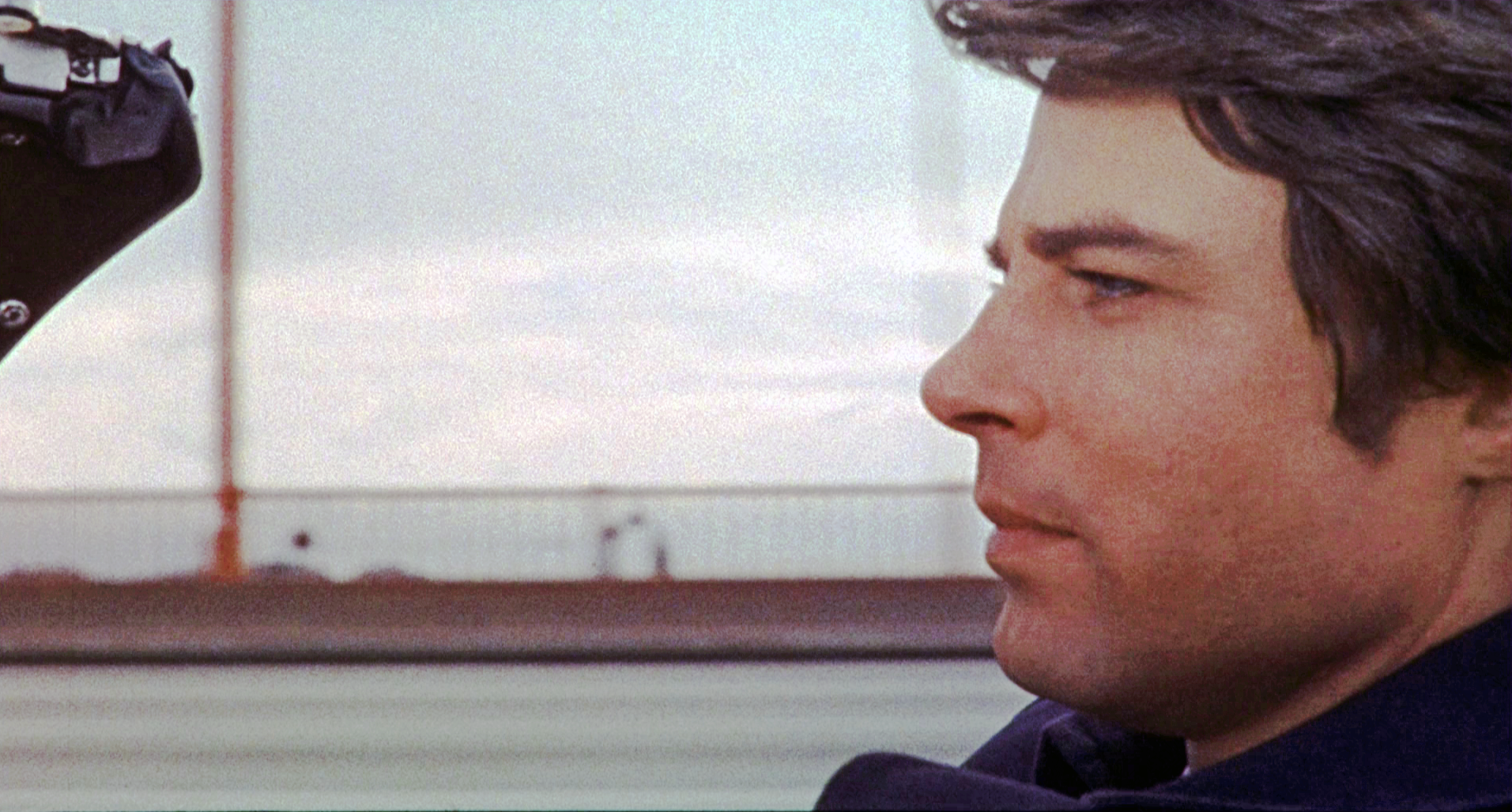
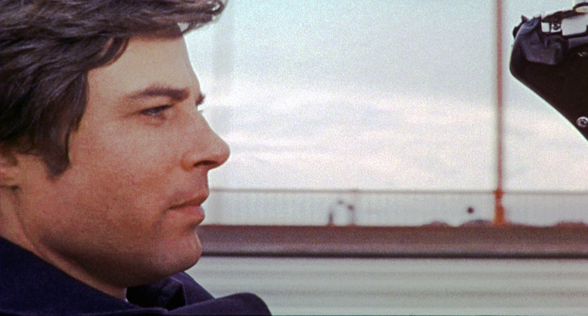
Then … What the …? He’s back in San Francisco driving along Auto Row past the Reynolds-Seiler Toyota dealer at 1465 Van Ness Avenue on the southwest corner of Pine Street; he then passes a Standard gas station across Pine (map). But in a repeat of the earlier continuity goof he is again wearing the dark overcoat.
… and Now, that block where the dealer was fell prey to the San Francisco Towers, a 250 unit senior living community complex and street level retail stores. The construction mess on Van Ness is the result of an ongoing upgrade of the thoroughfare to add dedicated bus lanes - observing its multi-year progress is, to residents, like watching grass grow. But the gas station is still there across Pine Street, and (interesting trivia) it’s a unique one - it’s the sole remaining Standard station in California. Intrigued? Read about it here.
He continues following that same train. The Johnson’s Wax building is a clue to this location.
Then … Next we see him on a bridge over a large body of water.
… and Now, Back in the Bay Area, again way north of his supposed route, he was traveling east to west on the steep rise to the elevated section of the San Mateo Bridge that spans San Francisco Bay from Foster City to Hayward (map). The arrow marks where he was in the above shot.
And finally he arrives at his destination, San Luis Obispo’s Southern Pacific depot. Or is it? And does he beat the train? Don’t miss the next post for the answers!